Hajariya
| Hajariya हजारिया | |
|---|---|
| Village development committee | |
 Black area indicates VDC | |
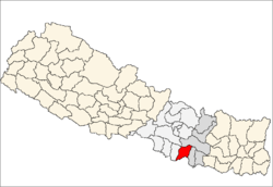
 Hajariya Location in Nepal | |
| Coordinates: 27°0′0″N 85°24′30″E / 27.00000°N 85.40833°ECoordinates: 27°0′0″N 85°24′30″E / 27.00000°N 85.40833°E | |
| Country | Nepal |
| Zone | Janakpur Zone |
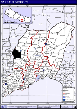
| District | Sarlahi District |
| Population (1991) | |
| • Total | 9,919 |
| Time zone | UTC+5:45 (Nepal Time) |
Hajariya is a village development committee (VDC) in Sarlahi District in the Janakpur Zone of south-eastern Nepal. Now it is included to barahathwa municipality.At the time of the 2011 Nepal census it had a population of 16,336 people living in 2814 individual households.
Hajariya is bounded by Barahathwa on the east, Sundarpur Choharwa on the south, Rautahat district on the west and Rajghat on the north.[1]
Economy
This VDC produces maize, potato, sugarcane and seasonable vegetables.
Education
Shree Saraswati Uchha Madhyamik Vidhyalaya is the higher secondary school of this VDC. Now, the education of this place is rapidly increasing. It has been observed that the most of the Students after higher secondary education migrate to City areas for the Quality education.
History
People of this VDC were highly affected during UCPN Maoists' civil war. More than 50 persons were killed by both parties during the period of war.[2]
References
- ↑ UN map of the municipalities of Sarlahi District
- ↑ "Nepal Census 2001", Nepal's Village Development Committees, Digital Himalaya, retrieved 15 November 2009 .