Patterson station (Metro-North)
Patterson | ||||||||||||||||||||||||||
|---|---|---|---|---|---|---|---|---|---|---|---|---|---|---|---|---|---|---|---|---|---|---|---|---|---|---|
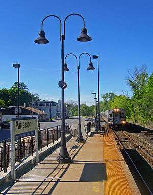 Southbound train approaching Patterson station | ||||||||||||||||||||||||||
| Location |
1 Front Street & Center Street Patterson, NY, 12563 | |||||||||||||||||||||||||
| Coordinates | 41°30′42″N 73°36′15″W / 41.51174°N 73.60428°WCoordinates: 41°30′42″N 73°36′15″W / 41.51174°N 73.60428°W | |||||||||||||||||||||||||
| Line(s) | ||||||||||||||||||||||||||
| Platforms | 1 side platform | |||||||||||||||||||||||||
| Tracks | 1 | |||||||||||||||||||||||||
| Connections |
| |||||||||||||||||||||||||
| Other information | ||||||||||||||||||||||||||
| Fare zone | 8 | |||||||||||||||||||||||||
| Traffic | ||||||||||||||||||||||||||
| Passengers (2007) |
37,908 | |||||||||||||||||||||||||
| Services | ||||||||||||||||||||||||||
| ||||||||||||||||||||||||||
Patterson is a Metro-North Railroad station that serves the residents of Patterson, New York via the Harlem Line. Trains leave for New York City every two hours, and about every 30 minutes during rush hour. It is 60.2 miles (96 km) from Grand Central Terminal and travel time to Grand Central is approximately one hour, 42 minutes.
This station is the first/last station in the Zone 8 Metro-North fare zone.
It is the northernmost station on the line in Putnam County, and the first station beyond the end of electrification. Contrary to the Metro-North website, Patterson station is farther west of New York State Route 22, and closer to New York State Route 311, which is just to the north.
History
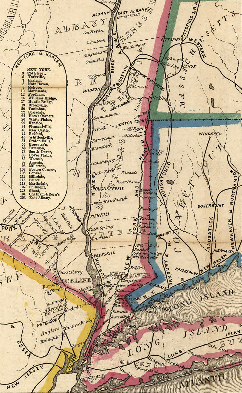
The New York and Harlem Railroad built their main line through Patterson towards Dover Plains in 1848. Evidence of a station in Patterson can be traced at least as far back as 1858.[1] NY&H was acquired by the New York Central and Hudson River Railroad in 1864 and eventually taken over by the New York Central Railroad. On August 3, 1952, a derailment of milk cars and other freight at the station took place, which resulted in no injuries or deaths, but nevertheless startled the community.[2] As with most of the Harlem Line, the merger of New York Central with Pennsylvania Railroad in 1968 transformed the station into a Penn Central Railroad station. Penn Central's continuous financial despair throughout the 1970s forced them to turn over their commuter service to the Metropolitan Transportation Authority, who eventually converted into a Metro-North station in 1983.
Station layout
The station consists of a four-car-long high-level side platform to the west of the track.
| P Platform level |
Street level | Exit/entrance and parking |
| Side platform, doors will open on the left or right | ||
| Track 1 | ← Harlem Line toward Southeast or Grand Central (Southeast) Harlem Line toward Wassaic (Pawling) → | |
References
- ↑ "New York and Harlem Railroad Map". 1858 – via I Ride the Harlem Line.
- ↑ Grogan, Louis V. (1989). The Coming of the New York and Harlem Railroad. Self-Published. pp. 166–167. ISBN 0-962120- 65-0.
External links

- Metro-North Railroad - Patterson
- List of upcoming train departure times from MTA
- Patterson Railroad History