Palandöken, Erzurum
| Palandöken | |
|---|---|
| District | |
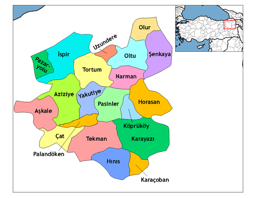 Location of Palandöken in Erzurum. | |
 Palandöken Location of Palandöken in Turkey. | |
| Coordinates: 39°54′20″N 41°15′57″E / 39.90556°N 41.26583°ECoordinates: 39°54′20″N 41°15′57″E / 39.90556°N 41.26583°E | |
| Country |
|
| Region | Eastern Anatolia |
| Province | Erzurum |
| Population (2012)[1] | |
| • Urban | 160,162 |
| • District | 162,162 |
| Time zone | UTC+2 (EET) |
| • Summer (DST) | UTC+3 (EEST) |
| Postal code | 25070, 25080, 25090 |
| Area code(s) | 442-233 ... |
| Licence plate | 25 |
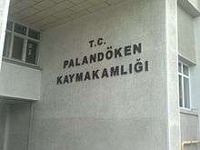
Palandöken ilçe governorate
Palandöken is a second level muınicipality and ilçe (district) of Greater Erzurum, Turkey. It is named after Palandöken Mountain which is a ski resort.
The ilçe center is at 39°54′20″N 41°15′57″E / 39.90556°N 41.26583°E within Erzurum.[2] There are 26 neighborhoods in Palandöken. The total population of Palandöken was 168430 as of 2016. [3]
The ice hockey venue Palandöken Ice Skating Hall was opened in 2008.
References
- ↑ "Population of province/district centers and towns/villages by districts - 2012". Address Based Population Registration System (ABPRS) Database. Turkish Statistical Institute. Retrieved 2013-02-27.
- ↑ Map page
- ↑ Population page (in Turkish)
This article is issued from
Wikipedia.
The text is licensed under Creative Commons - Attribution - Sharealike.
Additional terms may apply for the media files.