Nieuwpoort, Belgium
| Nieuwpoort | |||
|---|---|---|---|
| Municipality | |||
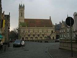 Belfry and city hall | |||
| |||
 Nieuwpoort Location in Belgium
Location of Nieuwpoort in West Flanders 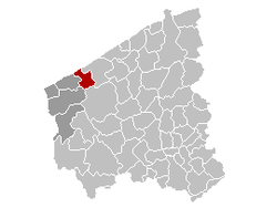 | |||
| Coordinates: 51°07′N 02°45′E / 51.117°N 2.750°ECoordinates: 51°07′N 02°45′E / 51.117°N 2.750°E | |||
| Country | Belgium | ||
| Community | Flemish Community | ||
| Region | Flemish Region | ||
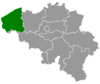
| Province | West Flanders | ||
| Arrondissement | Veurne | ||
| Government | |||
| • Mayor | Geert Vanden Broucke (CD&V) | ||
| • Governing party/ies | CD&V | ||
| Area | |||
| • Total | 31.00 km2 (11.97 sq mi) | ||
| Population (1 January 2017)[1] | |||
| • Total | 11,351 | ||
| • Density | 370/km2 (950/sq mi) | ||
| Postal codes | 8620 | ||
| Area codes | 058 | ||
| Website | www.nieuwpoort.be | ||
_wapen.svg.png)
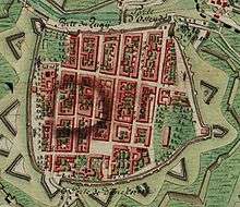
Nieuwpoort (Dutch pronunciation: [ˈniupoːrt]) (West Flemish: Nieuwpôort) (French: Nieuport) is a municipality located in Flanders, one of the three regions of Belgium, and in the Flemish province of West Flanders. The municipality comprises the city of Nieuwpoort proper and the towns of Ramskapelle and Sint-Joris. On January 1, 2008, Nieuwpoort had a total population of 11,062. The total area is 31.00 km² which gives a population density of 350 inhabitants per km². The current mayor of Nieuwpoort is Geert Vanden Broucke (CD&V)
In Nieuwpoort, the Yser flows into the North Sea. It is also the home of a statue created by Jan Fabre called Searching for Utopia.
History
It obtained city rights in 1163 from Count Philip of Flanders.
The Battle of Nieuwpoort, between the Dutch and the Spanish, happened here in 1600. The city was a Dunkirker base.
Painter Victor Boucquet made two of the altar-pieces for the great church in the 17th century.
The city was occupied by French forces for six years between 1757 and 1763, as part of the conditions of the Second Treaty of Versailles between France and Austria.
A large waterworks infrastructure project called the Ganzepoot (goose foot, in Dutch) was constructed in Nieuwpoort in the 19th century to drain the polders and channel water in and around the town and to the North Sea.
During the Battle of the Yser, part of the First Battle of Ypres in World War I, Hendrik Geeraert opened the sluice gates on the mouth of the river Yser twice to flood the lower lying land, thus halting the German advance.
Towns
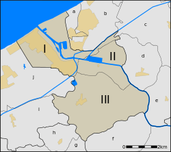
The old city centre of Nieuwpoort is located about three kilometers from the coast. Close to the sea, a new tourist centre has developed. Both parts form one contiguous built up area, connected by buildings along the Albert I Laan street and the fishing port. Besides Nieuwpoort proper, two small villages in the Flemish polders are part of the municipality, Sint-Joris and Ramskapelle.
| # | Name | Area | Population 1999 |
|---|---|---|---|
| I | Nieuwpoort | 10,18 | 9.437 |
| II | Sint-Joris | 5,54 | 259 |
| III | Ramskapelle | 15,28 | 555 |
Nieuwpoort is located by the sea. At the coastal line, it borders the municipalities Koksijde at its town Oostduinkerke and Middelkerke at its town Lombardsijde. Because the territory of the town of Ramskapelle expands far inland, Nieuwpoort has a large number of neighbouring towns, most of which are part of 2 large municipalities:
 Nieuwpoort, towns and neighbouring towns. The yellow areas are urban areas.
|
|
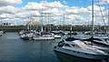 A view of Nieuwpoort marina from the south side with boats
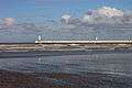 A view of the beach and the pier at Nieuwpoort
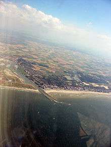 Nieuwpoort taken from the air
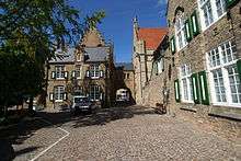 Hendrik-Geeraertplein square
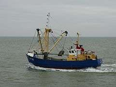 Fishing ship from Nieuwpoort
In literature
Part of the plot in Cecelia Holland's historical novel The Sea Beggars is laid in Nieuwpoort, in the preliminary states of the Eighty Years' War - with the sailor protagonists feeling oppressed under the harsh Spanish rule and eventually joining the rebellious Watergeuzen.
See also
References
- ↑ Population per municipality as of 1 January 2017 (XLS; 397 KB)
External links
| Wikimedia Commons has media related to Nieuwpoort, Belgium. |
| Wikivoyage has a travel guide for Nieuwpoort. |
- Official website - Mainly in Dutch, some info available in French and English
- Startpage of Nieuwpoort - Alle site's binnen Nieuwpoort
- Illustrated Article on Nieupoort & the Yser Front during WW1 at 'Battlefields Europe'
Places adjacent to Nieuwpoort, Belgium | ||||||||||
|---|---|---|---|---|---|---|---|---|---|---|
| ||||||||||