Lendelede
| Lendelede | |||
|---|---|---|---|
| Municipality | |||
 Church of Saint Blaise (Sint-Blasius) | |||
| |||
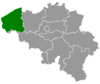
 Lendelede Location in Belgium
Location of Lendelede in West-Flanders  | |||
| Coordinates: 50°53′N 03°14′E / 50.883°N 3.233°ECoordinates: 50°53′N 03°14′E / 50.883°N 3.233°E | |||
| Country | Belgium | ||
| Community | Flemish Community | ||
| Region | Flemish Region | ||
| Province | West Flanders | ||
| Arrondissement | Kortrijk | ||
| Government | |||
| • Mayor | Georges Gheysens | ||
| • Governing party/ies | CD&V | ||
| Area | |||
| • Total | 13.15 km2 (5.08 sq mi) | ||
| Population (1 January 2017)[1] | |||
| • Total | 5,768 | ||
| • Density | 440/km2 (1,100/sq mi) | ||
| Postal codes | 8860 | ||
| Area codes | 051, 056 | ||
| Website | www.lendelede.be | ||


Lendelede is a municipality located in the Belgian province of West Flanders. The municipality comprises only the town of Lendelede proper. On January 1, 2006, Lendelede had a total population of 5,399. The total area is 13.15 km² which gives a population density of 411 inhabitants per km².
People from Lendelede
- Ludovicus Baekelandt
- Achille Delaere
- Jan Kuyckx
Gallery
 Ludovicus Baekelandt, 1774-1803, highwayman
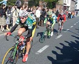 2007 Tour of Flanders through Lendelede with Jan Kuyckx (landbouwkrediet); Aleksandr Kuschynski (Liquigas); Evert Verbist (- Topsport Vlaanderen)
References
- ↑ Population per municipality as of 1 January 2017 (XLS; 397 KB)
External links

- Official website (in Dutch)
This article is issued from
Wikipedia.
The text is licensed under Creative Commons - Attribution - Sharealike.
Additional terms may apply for the media files.