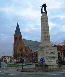
Langemark-Poelkapelle
| Langemark-Poelkapelle | |||
|---|---|---|---|
| Municipality | |||
 | |||
| |||
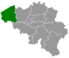
 Langemark-Poelkapelle Location in Belgium
Location of Langemark-Poelkapelle in West Flanders 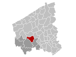 | |||
| Coordinates: 50°55′N 02°55′E / 50.917°N 2.917°ECoordinates: 50°55′N 02°55′E / 50.917°N 2.917°E | |||
| Country | Belgium | ||
| Community | Flemish Community | ||
| Region | Flemish Region | ||
| Province | West Flanders | ||
| Arrondissement | Ypres | ||
| Government | |||
| • Mayor | Alain Wyffels (CD&V) | ||
| • Governing party/ies | CD&V | ||
| Area | |||
| • Total | 52.53 km2 (20.28 sq mi) | ||
| Population (1 January 2017)[1] | |||
| • Total | 7,948 | ||
| • Density | 150/km2 (390/sq mi) | ||
| Postal codes | 8920 | ||
| Area codes | 057, 051 | ||
| Website | www.langemark-poelkapelle.be | ||

Langemark-Poelkapelle is a municipality located in the Belgian province of West Flanders.
Geography
Other places in the municipality include Bikschote, Langemark and Poelkapelle. On January 1, 2006, Langemark-Poelkapelle had a total population of 7,780. The total area is 52.53 km² which gives a population density of 148 inhabitants per km².
Iron harvest
Iron harvest from farmers is regularly collected by the Belgian army for disposal by controlled explosion at a specialist centre nearby.[2]
See also
Gallery
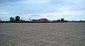 Farm at Langemark
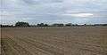 Fields at Langemark
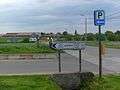
References
- ↑ Population per municipality as of 1 January 2017 (XLS; 397 KB)
- ↑ "Belgian soldiers tasked with clearing deadly WWI mines from Flanders". Mail Online. Retrieved 2017-04-14.
External links

- Official Website (in Dutch)
Places adjacent to Langemark-Poelkapelle | ||||||||||
|---|---|---|---|---|---|---|---|---|---|---|
| ||||||||||
This article is issued from
Wikipedia.
The text is licensed under Creative Commons - Attribution - Sharealike.
Additional terms may apply for the media files.