Natural Earth projection
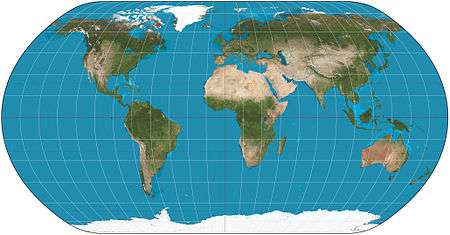
Natural Earth projection of the world.

The natural Earth projection with Tissot's indicatrix of deformation
The natural Earth projection is a pseudocylindrical map projection designed by Tom Patterson and introduced in 2012. It is neither conformal nor equal-area.
Definition
The natural Earth is defined by the following formulas:
- ,

where
- x, y are the Cartesian coordinates;
- λ is the longitude from the central meridian;
- φ is the latitude;
- l(φ) is the length of the parallel at latitude φ;
- d(φ) is the distance of the parallel from the equator at latitude φ.
l(φ) and d(φ) are given as polynomials, initially from interpolation of the following values in Flex Projector[1]:
| φ (degrees) | l(φ) | d(φ) |
|---|---|---|
| 0 | 1.0000 | 0.0000 |
| 5 | 0.9988 | 0.0620 |
| 10 | 0.9953 | 0.1240 |
| 15 | 0.9894 | 0.1860 |
| 20 | 0.9811 | 0.2480 |
| 25 | 0.9703 | 0.3100 |
| 30 | 0.9570 | 0.3720 |
| 35 | 0.9409 | 0.4340 |
| 40 | 0.9222 | 0.4958 |
| 45 | 0.9006 | 0.5571 |
| 50 | 0.8763 | 0.6176 |
| 55 | 0.8492 | 0.6769 |
| 60 | 0.8196 | 0.7346 |
| 65 | 0.7874 | 0.7903 |
| 70 | 0.7525 | 0.8435 |
| 75 | 0.7160 | 0.8936 |
| 80 | 0.6754 | 0.9394 |
| 85 | 0.6270 | 0.9761 |
| 90 | 0.5630 | 1.0000 |
The values for the southern hemisphere are calculated by changing the sign of the corresponding values for the northern hemisphere.
See also
References
- http://www.shadedrelief.com/NE_proj/
- https://web.archive.org/web/20160303235936/http://cartography.oregonstate.edu/pdf/2011_Savric_etal_PolynomialNaturalEarth.pdf
- ↑ "Natural Earth Projection: Home". www.shadedrelief.com. Archived from the original on 2012-04-07. Retrieved 2017-02-12.
It was originally designed in Flex Projector using graphical methods and now exists as a polynomial version.
This article is issued from
Wikipedia.
The text is licensed under Creative Commons - Attribution - Sharealike.
Additional terms may apply for the media files.