Whitehall, New Jersey
| Whitehall, New Jersey | |
|---|---|
| Unincorporated community | |
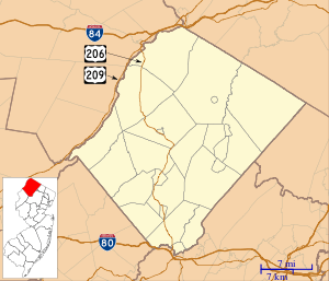 Whitehall, New Jersey Location within Sussex County. Inset: Location of Sussex County in the state of New Jersey.  Whitehall, New Jersey Whitehall, New Jersey (New Jersey)  Whitehall, New Jersey Whitehall, New Jersey (the US) | |
| Coordinates: 40°57′52″N 74°44′22″W / 40.96444°N 74.73944°WCoordinates: 40°57′52″N 74°44′22″W / 40.96444°N 74.73944°W | |
| Country |
|
| State |
|
| County | Sussex |
| Township | Andover |
| Elevation[1] | 781 ft (238 m) |
| GNIS feature ID | 881794[1] |
Whitehall is an unincorporated community located within Andover Township in Sussex County, New Jersey, United States.[1][2]
Whitehall is located approximately 1.5 mi (2.4 km) south of Andover.
Panther Lake, and the Panther Lake Camping Resort, occupy the east side of the settlement.[3][4] Located west of Whitehall is the northern tip of Allamuchy Mountain State Park.
History
The former Sussex Railroad passed through Whitehall.[2]
In 1872, it was noted that the largest building in Whitehall "was formerly a tavern where the Newark and Oswego stages used to stop".[2]
References
- 1 2 3 "Whitehall". Geographic Names Information System. United States Geological Survey.
- 1 2 3 Webb, Edward A. (1872). The Historical Directory of Sussex County, N.J.: Containing a Brief Summary of Events from Its First Settlement, with Descriptive and Historical Notices of Each Town. Sussex County (N.J.). p. 20.
- ↑ "Panther Lake". Geographic Names Information System. United States Geological Survey.
- ↑ "Driving Directions". Panther Lake Camping Resort. Retrieved January 2015. Check date values in:
|accessdate=(help)
Municipalities and communities of Sussex County, New Jersey, United States | ||
|---|---|---|
| Boroughs | 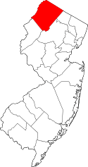 | |
| Town | ||
| Townships | ||
| CDPs | ||
| Other unincorporated communities | ||
This article is issued from
Wikipedia.
The text is licensed under Creative Commons - Attribution - Sharealike.
Additional terms may apply for the media files.