Swartswood, New Jersey
| Swartswood, New Jersey | |
|---|---|
| Unincorporated community | |
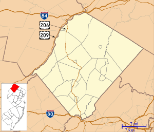 Swartswood, New Jersey Swartswood's location in Sussex County (Inset: Sussex County in New Jersey)  Swartswood, New Jersey Swartswood, New Jersey (New Jersey)  Swartswood, New Jersey Swartswood, New Jersey (the US) | |
| Coordinates: 41°05′13″N 74°49′38″W / 41.08694°N 74.82722°WCoordinates: 41°05′13″N 74°49′38″W / 41.08694°N 74.82722°W | |
| Country |
|
| State |
|
| County | Sussex |
| Townships | Hampton and Stillwater |
| Elevation | 160 m (525 ft) |
| Time zone | UTC-5 (Eastern (EST)) |
| • Summer (DST) | UTC-4 (EDT) |
| ZIP code | 07877 |
| Area code(s) | 862 & 973 |
| GNIS feature ID | 881044[1] |
Swartswood is an unincorporated community located on the border of Hampton and Stillwater townships in Sussex County, New Jersey, United States.[2] Swartswood is 4.4 miles (7.1 km) west-northwest of Newton. Swartswood has a post office with ZIP code 07877.[3][4]
References
- ↑ "Swartswood". Geographic Names Information System. United States Geological Survey.
- ↑ Locality Search, State of New Jersey. Accessed June 9, 2016.
- ↑ United States Postal Service (2012). "USPS - Look Up a ZIP Code". Retrieved 2012-02-15.
- ↑ "Postmaster Finder - Post Offices by ZIP Code". United States Postal Service. Retrieved July 25, 2013.
Municipalities and communities of Sussex County, New Jersey, United States | ||
|---|---|---|
| Boroughs | 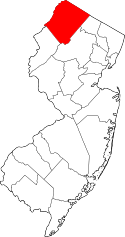 | |
| Town | ||
| Townships | ||
| CDPs | ||
| Other unincorporated communities | ||
This article is issued from
Wikipedia.
The text is licensed under Creative Commons - Attribution - Sharealike.
Additional terms may apply for the media files.