Nabiganj Upazila
| Nabiganj Thana নবীগঞ্জ | |
|---|---|
 | |
| Coordinates: 24°34′N 91°30.9′E / 24.567°N 91.5150°E | |
| Division | Sylhet Division |
| District | Habiganj District |
| Government | |
| • MP (Habiganj-1) | Abdul Munim Chowdhury Babu (Jatiya Party) |
| Area | |
| • Total | 439.6 km2 (169.7 sq mi) |
| Population | |
| • Total | 246,933 |
| • Density | 560/km2 (1,500/sq mi) |
| Demonym(s) | Nabiganji, Nobigonji, Nobigonzi |
| Time zone | UTC+6 (BST) |
| Postal code | 3000 |
Nabiganj (Bengali: নবীগঞ্জ) is an Upazila of Habiganj District[1] in the Division of Sylhet, Bangladesh.
Etymology
The name of the upazila, Nabiganj is derived from two words, Nabi and ganj, meaning "Prophetic neighbourhood". Other etymologies also say that it is named after the Prophet Muhammad.
Geography
Nabiganj is located at 24°34′01″N 91°30′51″E / 24.56701°N 91.51430°E . It has 41358 households and total area 439.6 km2.
Demographics
As of the 1991 Bangladesh census, Nabiganj has a population of 246933. Males constitute 50.27% of the population, and females 49.73%. This Upazila's eighteen up population is 126527. Nabiganj has an average literacy rate of 26.4% (7+ years), and the national average of 32.4% literate.[2]
Administration
Nabiganj has 13 Unions/Wards, 220 Mauzas/Mahallas, and 359 villages. 1 pourosova.
The Unions are:-
- Boro Bhakoir West
- Boro Bhakoir East
- Inatgonj
- Dighalbak
- Aushkandi
- Kurshi
- Korgaon
- Nabigonj
- Bausha
- Debpara
- Gajnaipur
- Kaliarbhanga &
- Paniumda
Notable Personalities
- Shah A M S Kibria: Ex-Finance Minister of Bangladesh, Bangladeshi economist, diplomat and politician.
- Dewan Farid Gazi: Politician
- Khalilur Rahman Choudhury Ex Member of Parliament
- Dr. Reza Kibria: Politician.
- Anudvaipayan Bhattacharya: Bangladeshi intellectual.
- Mahbubur Rab Sadi Bir Pratik: Martyr of liberation war
See also
References
- ↑ Kazi M Hasan Ali (2012), "Nabiganj Upazila", in Sirajul Islam and Ahmed A. Jamal, Banglapedia: National Encyclopedia of Bangladesh (Second ed.), Asiatic Society of Bangladesh
- ↑ "Population Census Wing, BBS". Archived from the original on 2005-03-27. Retrieved November 10, 2006.
| Upazila/Thana: | ||
|---|---|---|
Capital: Sylhet | ||
| Habiganj District | 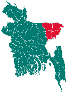 | |
| Moulvibazar District | ||
| Sunamganj District | ||
| Sylhet District | ||