Gowainghat Upazila
| Gowainghat গোয়াইনঘাট | |
|---|---|
| Upazila | |
 Gowainghat Location in Bangladesh | |
| Coordinates: 25°6.2′N 91°53.5′E / 25.1033°N 91.8917°ECoordinates: 25°6.2′N 91°53.5′E / 25.1033°N 91.8917°E | |
| Country |
|
| Division | Sylhet Division |
| District | Sylhet District |
| Area | |
| • Total | 486.1 km2 (187.7 sq mi) |
| Population (2001) | |
| • Total | 207,170 |
| • Density | 430/km2 (1,100/sq mi) |
| Time zone | UTC+6 (BST) |
| Website | Official Map of Gowainghat |
Gowainghat (Bengali: গোয়াইনঘাট) is an Upazila of Sylhet District in the Division of Sylhet, Bangladesh.[1]
Geography
Gowainghat is located at 25°06′10″N 91°53′30″E / 25.1028°N 91.8917°E . It has 34,133 households and a total area of 486.1 km². The rivers are quarried for their stones, in areas like Bichnakandi.[2]
Demographics
As of 2001 Bangladesh census, Gowainghat has a population of 207,170. Males constituted 51.80% of the population, and females 48.20%. Gowainghat has an average literacy rate of 22.8%.[3]
Administration
Gowainghat has 8 Unions, 260 Mauzas, and 267 villages.
The unions are:
- Alirgaon
- Fatehpur
- Lengura
- Nandirgaon
- Paschim Jaflong
- Purba Jaflong
- Rustampur
- Towakul
See also
References
| Wikimedia Commons has media related to Gowainghat Upazila. |
- ↑ Abdul Hai Al-Hadi (2012), "Gowainghat Upazila", in Sirajul Islam and Ahmed A. Jamal, Banglapedia: National Encyclopedia of Bangladesh (Second ed.), Asiatic Society of Bangladesh
- ↑ "Suspension of stones collection : Over 5 lakh workers jobless in Sylhet | Business News 24 BD". businessnews24bd.com. Retrieved 2016-11-29.
- ↑ "Census Results by Upazila/Thana" (PDF). Bangladesh Bureau of Statistics. 2001. Archived from the original (PDF) on November 24, 2007. Retrieved 2008-08-27.
Capital: Sylhet | ||
| Habiganj District | 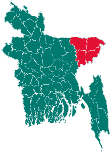 | |
| Moulvibazar District | ||
| Sunamganj District | ||
| Sylhet District | ||
This article is issued from
Wikipedia.
The text is licensed under Creative Commons - Attribution - Sharealike.
Additional terms may apply for the media files.