Chunarughat Upazila
| Chunarughat চুনারুঘাট | |
|---|---|
| Upazila | |
 Chunarughat Location in Bangladesh | |
| Coordinates: 24°12.5′N 91°31.3′E / 24.2083°N 91.5217°ECoordinates: 24°12.5′N 91°31.3′E / 24.2083°N 91.5217°E | |
| Country |
|
| Division | Sylhet Division |
| District | Habiganj District |
| Area | |
| • Total | 495.52 km2 (191.32 sq mi) |
| Population (1991) | |
| • Total | 233,752 |
| • Density | 470/km2 (1,200/sq mi) |
| Time zone | UTC+6 (BST) |
| Website | Official Map of Chunarughat |
Chunarughat (Bengali: চুনারুঘাট) is an Upazila of Habiganj District[1] in the Division of Sylhet, Bangladesh.
Geography
Chunarughat is located at 24°12′30″N 91°31′20″E / 24.2083°N 91.5222°E . It has 43660 households and total area 495.52 km².
Demographics
As of the 1991 Bangladesh census, Chunarughat has a population of 233752. Males constitute 50.2% of the population, and females 49.8%. This Upazila's eighteen up population is 119571. Chunarughat has an average literacy rate of 49.2% (7+ years), and the national average of 32.4% literate.[2]
Administration
Chunarughat has one Pourosova & 10 Unions/Wards, 165 Mauzas/Mahallas, and 377 villages. The unions are:
- Ahammadabad
- Chunarughat
- Deorgach
- Gazipur
- Miashi
- Paikpara
- Ranigaon
- Shankhola
- Shatiajuri
- Ubahata
Archaeological heritage

Mazar Sharif of Syed Nasir Uddin, Murarband Darbar Sharif

Road Map of Murarband Darbar Sharif
See also
References
- ↑ Jayanta Singh Roy (2012), "Chunarughat Upazila", in Sirajul Islam; Ahmed A. Jamal, Banglapedia: National Encyclopedia of Bangladesh (Second ed.), Asiatic Society of Bangladesh
- ↑ "Population Census Wing, BBS". Archived from the original on 2005-03-27. Retrieved November 10, 2006.
- ↑ Songbad, Daily Sylheter (17 November 2015). "প্রাচীন তরফ রাজ্যের সংক্ষিপ্ত ইতিবৃত্ত" (in Bengali).
- ↑ "মুড়ারবন্দ তরফ রাজ্যের প্রথম রাজধানী ও সৈয়দ বংশের উৎসস্থল" (in Bengali).
| Upazila/Thana: | ||
|---|---|---|
Capital: Sylhet | ||
| Habiganj District | 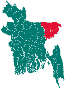 | |
| Moulvibazar District | ||
| Sunamganj District | ||
| Sylhet District | ||
This article is issued from
Wikipedia.
The text is licensed under Creative Commons - Attribution - Sharealike.
Additional terms may apply for the media files.