Ajmiriganj Upazila
| Ajmiriganj আজমিরিগঞ্জ | |
|---|---|
| Upazila | |
 Ajmiriganj Location in Bangladesh | |
| Coordinates: 24°32.8′N 91°15′E / 24.5467°N 91.250°ECoordinates: 24°32.8′N 91°15′E / 24.5467°N 91.250°E | |
| Country |
|
| Division | Sylhet Division |
| District | Habiganj District |
| Area | |
| • Total | 223.98 km2 (86.48 sq mi) |
| Population (1991) | |
| • Total | 86,810 |
| • Density | 388/km2 (1,000/sq mi) |
| Time zone | UTC+6 (BST) |
| Website | Official Map of Ajmiriganj |
Ajmiriganj (Bengali: আজমিরিগঞ্জ) is an Upazila of Habiganj District in the Division of Sylhet, Bangladesh.[1]
History
In 1907 Abidabaad became Ajmiriganj thana under Assam government. In 1983 Ajmiriganj thana was turned into an upazila. Name was derived from Aijadam > Ajmardan > Aijmadam > Abidabaad > Ajmiriganj.
It needs to be mentioned that Jalsukh Krishna Govinda Public High School was established in 1876 and AJmiriganj Amalgamated Bir Charan Govt Pilot High School was established in 1930.
Ajmiriganj Bazar (main town), on the other hand, consists of 2 mouzas, with an area of 5.73 km2. The town has one Dak-Banglow. Town also have a number of buildings, which are from as early as 1800 and structurally beautiful, some of these were financed by Moharaja of Tripura. During the war of liberation in 1971 a prolonged eighteen hours encounter between the freedom fighters and the Pak army was held on 16 November in which freedom fighter Jagatyoti was killed. Besides, the Pak army brutally killed 11 innocent villagers
Geography
Ajmiriganj is located at 24°32′50″N 91°15′00″E / 24.5472°N 91.2500°E . It has 14713 households and total area 223.98 km².
Demographics
As of the 1991 Bangladesh census, Ajmiriganj has a population of 86810. Males constitute 51.11% of the population, and females 48.89%. This Upazila's eighteen up population is 43762. Ajmiriganj has an average literacy rate of 22.4% (7+ years), and the national average of 32.4% literate.[2]
Administration
Ajmiriganj has 1 Pouroshova
- Ajmiriganj Pouroshova
5 Unions/Wards
- Birat(Ajmiriganj Sadar)
- Jolshuka
- Kakailcheo
- Shibpasha
- Paharpur (Badalpur)
and 68 Mauzas/Mahallas, and 79 villages. Shorafnagar, Pukurpar, Jagatpur, Samipur, Nagar, Ajeemnagar, Shorifnagar, Shukribari, Krishnanagar, Fotehpur, etc.
See also
References
- ↑ Jiban Kumar Chanda (2012), "Ajmiriganj Upazila", in Sirajul Islam and Ahmed A. Jamal, Banglapedia: National Encyclopedia of Bangladesh (Second ed.), Asiatic Society of Bangladesh
- ↑ "Population Census Wing, BBS". Archived from the original on 2005-03-27. Retrieved November 10, 2006.
| Upazila/Thana: | ||
|---|---|---|
Capital: Sylhet | ||
| Habiganj District | 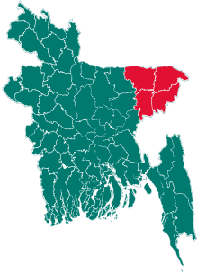 | |
| Moulvibazar District | ||
| Sunamganj District | ||
| Sylhet District | ||