Ndilǫ
| Ndilǫ | |
|---|---|
| Yellowknives Dene First Nation (Ndilǫ) | |
 | |
 Ndilǫ | |
| Coordinates: 62°28′40″N 114°20′03″W / 62.47778°N 114.33417°WCoordinates: 62°28′40″N 114°20′03″W / 62.47778°N 114.33417°W | |
| Country | Canada |
| Territory | Northwest Territories |
| Region | North Slave Region |
| Territorial electoral district | Tu Nedhé-Wiilideh |
| Census division | Fort Smith Region, Northwest Territories |
| Government | |
| • Chief | Ernest Betsina |
| • Chief Executive Officer | John Carter |
| • MLA | Bob Bromley |
| Elevation | 157 m (515 ft) |
| Population | |
| • Total | 200 (2,007 est.) |
| Time zone | UTC−7 (Mountain (MST)) |
| • Summer (DST) | UTC−6 (MDT) |
| Canadian Postal code | X1A |
| Area code(s) | 867 |
| Website | www.ykdene.com |
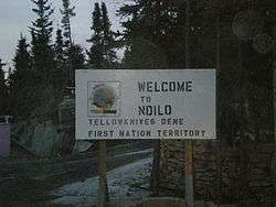
Ndilǫ /ˈdiːloʊ/ is a First Nations community in the North Slave Region of the Northwest Territories, Canada. The small Dene community is located on the edge of Yellowknife on the tip of Latham Island. It has a population of approximately 200 people. Ndilǫ and Dettah are the communities of the Yellowknives. Ndilǫ is represented by the Yellowknives Dene First Nation (Ndilǫ) and are part of the Akaitcho Territory Government.[1]
The land was set aside for use by status Indians by the Government of Canada in 1947 and was called 'Lot 500' on the official register. In 1959, the government built the first ten permanent houses for Dene families. They were colourful homes and so people began referring to the community as 'Rainbow Valley'. In the 1970s there were 200 residents living in 20 houses. [2] The name was officially changed to Ndilǫ in 1991, which means "end of the island" in the local Dene dialect. [3]
Noted residents
References
- ↑ Indian and Northern Affairs Canada Archived 2007-06-11 at Archive.is
- ↑ "Way Found for Indians to Capture Yellowknife Land" The Yellowknifer, May 13, 1976
- ↑ "Rainbow Valley Officially Renamed" The Yellowknifer, July 12, 1991
External links
| Wikimedia Commons has media related to Ndilǫ. |
| Census divisions | |||||||
|---|---|---|---|---|---|---|---|
| Former census divisions | |||||||
| Dehcho Region |
| ||||||
| Inuvik Region |
| ||||||
| North Slave Region |
| ||||||
| Sahtu Region |
| ||||||
| South Slave Region |
| ||||||
| Weather stations (outside of communities) | |||||||
| Mine sites |
| ||||||
| DEW line and NWS sites |
| ||||||
| Hudson's Bay Company trading posts | |||||||
| Former districts |
| ||||||
| |||||||