Fort Providence
| Fort Providence Zhahti Koe or Zhahti Kue | |
|---|---|
| Hamlet | |
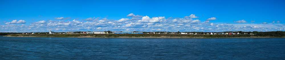
 Fort Providence from the Mackenzie River | |
 Fort Providence  Fort Providence | |
| Coordinates: 61°21′17″N 117°39′36″W / 61.35472°N 117.66000°WCoordinates: 61°21′17″N 117°39′36″W / 61.35472°N 117.66000°W | |
| Country | Canada |
| Territory | Northwest Territories |
| Region | South Slave Region |
| Constituency | Deh Cho |
| Census division | Region 4 |
| Hamlet | 1 January 1987 |
| Government | |
| • Mayor | Sam Gargan |
| • Senior Administrative Officer | Susan Christie |
| • MLA | Michael McLeod |
| Area[1] | |
| • Land | 255.05 km2 (98.48 sq mi) |
| Elevation | 160 m (520 ft) |
| Population (2011)[1] | |
| • Total | 695 |
| • Density | 2.7/km2 (7/sq mi) |
| Time zone | UTC-7 (Mountain (MST)) |
| • Summer (DST) | UTC-6 (MDT) |
| Canadian Postal code | X0E 0L0 |
| Area code(s) | 867 |
| Telephone exchange | 699 |
| - Living cost | 137.5A |
| - Food price index | 134.7B |
|
Sources: Department of Municipal and Community Affairs,[2] Prince of Wales Northern Heritage Centre,[3] Canada Flight Supplement[4] ^A 2013 figure based on Edmonton = 100[5] ^B 2015 figure based on Yellowknife = 100[5] | |
Fort Providence (Slavey language: Zhahti Koe or Zhahti Kue "mission house") is a hamlet in the South Slave Region of the Northwest Territories, Canada. Located west of Great Slave Lake, it has all-weather road connections by way of the Yellowknife Highway (Great Slave Highway) branch off the Mackenzie Highway, and the Deh Cho Bridge opened November 30, 2012 near Fort Providence over the Mackenzie. The bridge replaces the ice bridge and ferry, enabling year-round crossing of the river.
Fort Providence is well known for hosting the annual Mackenzie Days celebrations in August each year.
Demographics
The recorded population was 695 in the 2016 Census, a decrease of 5.3% from 2011. Of these the majority, 620, were Indigenous people, made up of 590 First Nations, Dene people, and 30 Métis.[1] In 2017 the Government of the Northwest Territories reported that the population was 770 with an average yearly growth rate of 0.3% from 2007.[5]
| Historical population | |||||||||||||||||||||||||||||||||||||||||||||||||||||||||||||||||||||||||
|---|---|---|---|---|---|---|---|---|---|---|---|---|---|---|---|---|---|---|---|---|---|---|---|---|---|---|---|---|---|---|---|---|---|---|---|---|---|---|---|---|---|---|---|---|---|---|---|---|---|---|---|---|---|---|---|---|---|---|---|---|---|---|---|---|---|---|---|---|---|---|---|---|---|
|
| ||||||||||||||||||||||||||||||||||||||||||||||||||||||||||||||||||||||||
| Sources: NWT Bureau of Statistics (2001 - 2017)[6] | |||||||||||||||||||||||||||||||||||||||||||||||||||||||||||||||||||||||||
First Nations
The Dene of the community are represented by the Deh Gah Gotie Dene Band[7] and the Métis by Fort Providence Métis Nation.[8] Both groups belong to the Dehcho First Nations.[9]
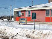
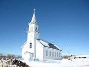
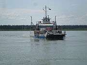
Gallery
.jpg)


Climate
Fort Providence has a continental subarctic climate typical of the Northwest Territories' populated areas. It is marked by a long cold winter season and short, warm summers, that in many ways are warmer than expected for an area so far north. Transition seasons are extremely short, with temperatures rising and falling quickly in respective seasons.
| Climate data for Fort Providence, 1981–2010 normals, extremes 1943–present | |||||||||||||
|---|---|---|---|---|---|---|---|---|---|---|---|---|---|
| Month | Jan | Feb | Mar | Apr | May | Jun | Jul | Aug | Sep | Oct | Nov | Dec | Year |
| Record high °C (°F) | 7.0 (44.6) |
9.9 (49.8) |
16.5 (61.7) |
24.0 (75.2) |
31.3 (88.3) |
34.4 (93.9) |
35.2 (95.4) |
36.1 (97) |
30.3 (86.5) |
24.4 (75.9) |
12.8 (55) |
11.8 (53.2) |
36.1 (97) |
| Average high °C (°F) | −18.9 (−2) |
−12.9 (8.8) |
−6.2 (20.8) |
5.8 (42.4) |
12.8 (55) |
20.9 (69.6) |
23.5 (74.3) |
20.4 (68.7) |
13.4 (56.1) |
3.2 (37.8) |
−7.7 (18.1) |
−15.1 (4.8) |
3.3 (37.9) |
| Daily mean °C (°F) | −23.4 (−10.1) |
−18.7 (−1.7) |
−13.6 (7.5) |
−1.0 (30.2) |
6.3 (43.3) |
13.5 (56.3) |
16.9 (62.4) |
14.0 (57.2) |
7.9 (46.2) |
−0.8 (30.6) |
−11.5 (11.3) |
−19.2 (−2.6) |
−2.5 (27.5) |
| Average low °C (°F) | −27.8 (−18) |
−24.3 (−11.7) |
−20.9 (−5.6) |
−7.7 (18.1) |
−0.3 (31.5) |
6.0 (42.8) |
10.1 (50.2) |
7.6 (45.7) |
2.4 (36.3) |
−4.8 (23.4) |
−15.2 (4.6) |
−23.1 (−9.6) |
−8.2 (17.2) |
| Record low °C (°F) | −49.4 (−56.9) |
−50.0 (−58) |
−45.0 (−49) |
−41.1 (−42) |
−22.2 (−8) |
−5.6 (21.9) |
−2.0 (28.4) |
−2.8 (27) |
−14.4 (6.1) |
−27.3 (−17.1) |
−44.4 (−47.9) |
−49.4 (−56.9) |
−50.0 (−58) |
| Average relative humidity (%) (at 1500 LST) | 74.9 | 67.6 | 53.1 | 44.4 | 41.8 | 41.7 | 47.1 | 51.4 | 57.6 | 71.3 | 84.0 | 80.2 | 59.6 |
| Source: Environment Canada[10][11] | |||||||||||||
See also
References
- 1 2 3 Census Profile, 2016 Census Fort Providence, Hamlet (Census subdivision), Northwest Territories and Northwest Territories (Territory)
- ↑ "NWT Communities - Fort Providence". Government of the Northwest Territories: Department of Municipal and Community Affairs. Retrieved 13 January 2014.
- ↑ "Northwest Territories Official Community Names and Pronunciation Guide". Prince of Wales Northern Heritage Centre. Yellowknife: Education, Culture and Employment, Government of the Northwest Territories. Archived from the original on 2016-01-13. Retrieved 2016-01-13.
- ↑ Canada Flight Supplement. Effective 0901Z 19 July 2018 to 0901Z 13 September 2018.
- 1 2 3 "Fort Providence - Statistical Profile (2001-2012)" (PDF). NWT Bureau of Statistics. Archived (PDF) from the original on 2018-08-29.
- ↑ Population Estimates By Community from the GNWT
- ↑ Deh Gah Gotie Dene Band
- ↑ Fort Providence Métis
- ↑ Dehcho First Nations
- ↑ "Fort Providence" (CSV (3069 KB)). Canadian Climate Normals 1981–2010. Environment Canada. Climate ID: 2201799. Retrieved 2014-01-09.
- ↑ "Fort Providence". Canadian Climate Data. Environment Canada. Retrieved 9 August 2016.
External links
| Wikimedia Commons has media related to Fort Providence. |
| Census divisions | |||||||
|---|---|---|---|---|---|---|---|
| Former census divisions | |||||||
| Dehcho Region |
| ||||||
| Inuvik Region |
| ||||||
| North Slave Region |
| ||||||
| Sahtu Region |
| ||||||
| South Slave Region |
| ||||||
| Weather stations (outside of communities) | |||||||
| Mine sites |
| ||||||
| DEW line and NWS sites |
| ||||||
| Hudson's Bay Company trading posts | |||||||
| Former districts |
| ||||||
| |||||||