Municipality of Miren-Kostanjevica
| Municipality of Miren-Kostanjevica Občina Miren - Kostanjevica | |
|---|---|
| Municipality | |
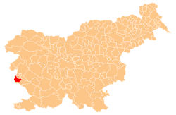 Location of the Municipality of Miren-Kostanjevica in Slovenia | |
| Coordinates: 45°51′N 13°38′E / 45.850°N 13.633°ECoordinates: 45°51′N 13°38′E / 45.850°N 13.633°E | |
| Country |
|
| Government | |
| • Mayor | Mauricij Humar |
| Area | |
| • Total | 62.8 km2 (24.2 sq mi) |
| Population (2002)[1] | |
| • Total | 4,741 |
| • Density | 75/km2 (200/sq mi) |
| Time zone | UTC+01 (CET) |
| • Summer (DST) | UTC+02 (CEST) |
The Municipality of Miren-Kostanjevica (pronounced [ˈmiːɾən kɔˈstaːnjɛʋitsa]; Slovene: Občina Miren - Kostanjevica, Italian: Comune di Merna Castagnevizza) is a municipality in western Slovenia, on the border with Italy.
Miren-Kostanjevica is part of the Goriška region of the Slovene Littoral, and its main settlements are Miren and Kostanjevica na Krasu. Miren is located in the lowest part of the Vipava Valley.[2]
Historically, the area was connected with the neighbouring village of Savogna d'Isonzo (Slovenian: Sovodnje ob Soči), which was left in Italy after the Paris Peace Treaty of February 1947. Since the second half of the 19th century, Miren has been a commercial center and a center of light industry, strongly linked to the Gorizia and Monfalcone (Slovenian: Tržič) urban areas. Kostanjevica na Krasu, on the other hand, is a center of a larger underpopulated rural area located on the high Karst Plateau. In the local self-government reform of 1994, the two centers united to form a single municipality. Since 1947, both localities have gravitated towards the Nova Gorica–Šempeter conurbation, where many locals commute daily.
Miren has a border crossing into Italy.
Notable natives and residents
- Oskar Kogoj, designer
- Dean Komel, philosopher
- Drago Marušič, politician, governor of the Drava Banovina (1931–34)
- Negovan Nemec, sculptor
- Igor Torkar, writer and political activist
- Stanko Vuk, poet and anti-fascist activist
References
External links
| Wikimedia Commons has media related to Municipality of Miren–Kostanjevica. |
| Settlements | Administrative centre: Miren
| |
|---|---|---|
| Landmarks | ||
| Notable people | ||