Poljčane
| Poljčane | |
|---|---|
| Settlement | |
 Poljčane, view from Mt. Boč | |
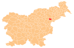
 Poljčane Location of Poljčane in Slovenia | |
| Coordinates: 46°19′N 15°35′E / 46.317°N 15.583°ECoordinates: 46°19′N 15°35′E / 46.317°N 15.583°E | |
| Country |
|
| Government | |
| • Mayor | Stanislav Kovačič |
| Area | |
| • Total | 2.5 km2 (1.0 sq mi) |
| Population (2012)[1] | |
| • Total | 1,135 |
| • Density | 456/km2 (1,180/sq mi) |
| Time zone | UTC+01 (CET) |
| • Summer (DST) | UTC+02 (CEST) |
Poljčane (pronounced [pɔlˈtʃaːnɛ]) is a settlement in northeastern Slovenia. It is the centre of the Municipality of Poljčane. It lies 35 km south of Maribor and 35 km northeast of Celje. Traditionally the area was part of the Styria region. The town lies in the Dravinja Valley north of Mount Boč. It is a crossing of two important regional roads, the route from Maribor to Rogaška Slatina and the route from Celje to Ptuj. The railway line from Ljubljana to Maribor runs through the settlement, and the town has a railway station. There are also a primary school, a health centre, a post office, two supermarkets, several small inns and bars, and some restaurants.
Poljčane is a popular starting point for excursions to Mount Boč, a popular destination for day trips with mountain bikes or on foot. The top of the mountain offers a beautiful view of eastern Slovenia.
Economy
The town has some industry; mostly wood production, construction, and electronics. The surrounding area is also heavily cultivated. Many people commute to work to Slovenska Bistrica, Pragersko, Maribor, Slovenske Konjice, and Celje.
References
- ↑ "Poljčane, Poljčane". Place Names. Statistical Office of the Republic of Slovenia. Retrieved 21 August 2012.
External links

- [http://v1.geopedia.si/Geopedia_en.html#T973_x499072_y112072_s9_b4 Poljčane on Geopedia]
- Poljčane municipal site