Motza Illit
| Motza Illit | |
|---|---|
 | |
 Motza Illit | |
| Coordinates: 31°47′35.03″N 35°9′28.29″E / 31.7930639°N 35.1578583°ECoordinates: 31°47′35.03″N 35°9′28.29″E / 31.7930639°N 35.1578583°E | |
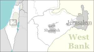
| District | Jerusalem |
| Council | Mateh Yehuda |
| Founded | 1933 |
| Founded by | Motza residents |
| Population (2017)[1] | 1,107 |
Motza Illit (Hebrew: מוֹצָא עִלִּית, מוצא עילית, lit. Upper Motza) is a community settlement on the outskirts of Jerusalem, Israel. It falls under the jurisdiction of Mateh Yehuda Regional Council. In 2017 it had a population of 1,107.[1]
History
Settlement in the area goes back to ancient times, with thousands of year old terraces and archeological remains in the area. In 1929, old Motza was attacked by its Arab neighbors and many residents were murdered. Four years later, a new moshav, Motza Ilit, was established at a higher location on the same hill.[2]
In January 1934, a house-warming party was held by twenty Jewish families who had built homes in Motza Illit with the aid of the Jewish National Council ("Va'ad Leumi") and emergency funds.[3]
Motza Illit overlooks the Judean mountains, offering a view of the churches and monasteries of Ein Karem, the Beit Zayit water reservoir and the Jerusalem Forest.
 Seven Sisters Road, 1948
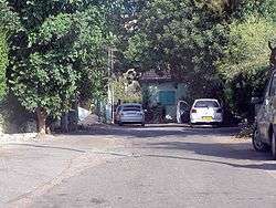
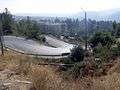 Seven Sisters Road to Motza Illit, 2010
See also
- People from Motza Illit
References
- 1 2 "List of localities, in Alphabetical order" (PDF). Israel Central Bureau of Statistics. Retrieved August 26, 2018.
- ↑ Planting from the Remains
- ↑ Upper Motza Families Celebrate Settlement of New Jewish Workers