Tal Shahar
| Tal Shahar | |
|---|---|
 | |
 Tal Shahar | |
| Coordinates: 31°48′22.32″N 34°54′12.95″E / 31.8062000°N 34.9035972°ECoordinates: 31°48′22.32″N 34°54′12.95″E / 31.8062000°N 34.9035972°E | |
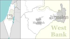
| District | Jerusalem |
| Council | Mateh Yehuda |
| Affiliation | Moshavim Movement |
| Founded | 1948 |
| Founded by | Greek, Polish and Turkish Jews |
| Population (2017)[1] | 1,362 |
| Website | www.tal-shahar.org.il |

Cyclamen persicum flowers in Tal Shahar's Cyclamen Hill
Tal Shahar (Hebrew: טַל שַׁחַר, lit. Dawn Dew) is a moshav in central Israel. Located between Gedera and Latrun, it falls under the jurisdiction of Mateh Yehuda Regional Council. In 2017 it had a population of 1,362.[1]
History
The village was established in 1948 by immigrants from Greece, Poland and Turkey on the Burma Road on land that had belonged to the depopulated Palestinian village of Khirbat Bayt Far in order to prevent Jerusalem being separated from the rest of Israel.[2][3][4] It was named after Henry Morgenthau, Jr. (Morgentau is German for Morning Dew).
References
- 1 2 "List of localities, in Alphabetical order" (PDF). Israel Central Bureau of Statistics. Retrieved August 26, 2018.
- ↑ Khalidi, Walid (1992). All That Remains:The Palestinian Villages Occupied and Depopulated by Israel in 1948. Washington D.C.: Institute for Palestine Studies. p. 364. ISBN 0-88728-224-5.
- ↑ Morris, Benny (2004). The Birth of the Palestinian Refugee Problem Revisited. Cambridge University Press. p. xxi. ISBN 978-0-521-00967-6.
- ↑ History Tal Shahar
External links
This article is issued from
Wikipedia.
The text is licensed under Creative Commons - Attribution - Sharealike.
Additional terms may apply for the media files.