Aviezer
| Aviezer | |
|---|---|
 Aviezer as viewed from the Elah Valley | |
 Aviezer | |
| Coordinates: 31°40′53.75″N 35°1′0.48″E / 31.6815972°N 35.0168000°ECoordinates: 31°40′53.75″N 35°1′0.48″E / 31.6815972°N 35.0168000°E | |
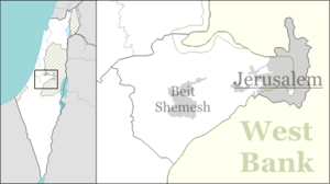
| District | Jerusalem |
| Council | Mateh Yehuda |
| Affiliation | Hapoel HaMizrachi |
| Founded | 8 April 1958 |
| Founded by | Iranian immigrants |
| Population (2017)[1] | 883 |
Aviezer (Hebrew: אֲבִיעֶזֶר) is a small religious moshav in central Israel. Located nine kilometres south-west of Beit Shemesh, at the east end of the Elah valley, it falls under the jurisdiction of Mateh Yehuda Regional Council. In 2017 it had a population of 883.[1]
History
The moshav was founded on 8 April 1958 by immigrants from Iran and by Cochin Jews from Kochi, being the chief ethnic constituent, and was initially named Adulam 9. It was later renamed after Aviezer Zigmond Gestetner, a former president of the Jewish National Fund in the United Kingdom. It was established on land belonging to the depopulated Palestinian village of Bayt Nattif.[2] Today, the site of Aviezer lies within the "green-line" of the 1949 Armistice Agreements.[3]
Gallery
 Moshav Aviezer, overlooking the Elah Valley
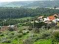 Moshav Aviezer as seen from ruin, Um Ra'us
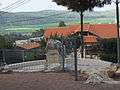 House in Moshav Aviezer
 The Ruin of Um Ra'us, near Moshav Aviezer
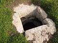 Cistern at the Ruin of Um Ra'us, near Moshav Aviezer
 Um Ra'us, dating back to Hellenistic, Roman and Byzantine times
 Mouth of hewn sepulchre at Um er-Rus, near Moshav Aviezer
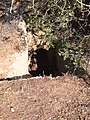 Burial tomb carved from rock in Khirbet Malkat-ha near Aviezer
 Olive press at Khirbet Malkat-ha
 Pit with iron grating
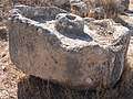 Broken olive press near Aviezer
References
| Wikimedia Commons has media related to Aviezer. |
- 1 2 "List of localities, in Alphabetical order" (PDF). Israel Central Bureau of Statistics. Retrieved August 26, 2018.
- ↑ Khalidi, Walid (1992). All That Remains: The Palestinian Villages Occupied and Depopulated by Israel in 1948. Washington D.C.: Institute for Palestine Studies. p. 212. ISBN 0-88728-224-5.
- ↑ Har’el: Palmach brigade in Jerusalem, by Zvi Dror (ed. Nathan Shoḥam), Hakibbutz Hameuchad Publishers: Benei Barak 2005, p. 273
This article is issued from
Wikipedia.
The text is licensed under Creative Commons - Attribution - Sharealike.
Additional terms may apply for the media files.