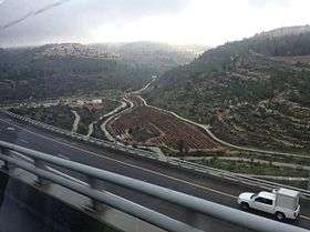
Jerusalem District
| Jerusalem District | |
|---|---|
|
| |
| - transcription(s) | |
| • Hebrew | מחוז ירושלים |
| • Arabic | منطقة اورشليم (القدس) |
_(semi-Israel_areas_hatched).svg.png) | |
| Cities | 2 |
| Local Councils | 3 |
| Regional Councils | 1 |
| Capital | Jerusalem |
| Area | |
| • Total | 652 km2 (252 sq mi) |
| Population (2016) | |
| • Total | 1,083,300 |
| ISO 3166 code | IL-JM |

The Jerusalem District (Hebrew: מחוז ירושלים; Arabic: منطقة اورشليم (القدس)) is one of six administrative districts of Israel. The district capital is Jerusalem. The Jerusalem District has a land area of 652 km². The population of 1,083,300 is 66.6% Jewish and 31.8% Arab[1]. A fifth (21%) of the Arabs in Israel live in the Jerusalem District, which includes both East and West Jerusalem.[2] Israel's annexation of East Jerusalem has not been recognized by the international community.[3]
The majority of Arabs in the Jerusalem District are Palestinians, eligible for citizenship under Israeli law, but non-citizens by collective choice. The minority are Israeli Arabs living in Abu Ghosh, Beit Safafa and East Jerusalem, where Israeli Arab professionals have settled since the late 1970s, mainly for the provision of legal and other services to the local population.[4] The non-Jewish population is 28.3% Muslims, 1.8% Christians and 1.4% unclassified by religion.[5]
Administrative sub-regions
| Cities | Local Councils | Regional Councils |
|---|---|---|
The Jerusalem Municipality, including East Jerusalem and other annexed parts of the West Bank, constituted with 125 km² about 19% of the Jerusalem District in 2008.[6]
See also
References
- ↑ "Localities And Population, By Population Group, District, Sub-District And Natural Region" (PDF). Israel census bureau of statistics. 2016.
- ↑ The Future of the Global Muslim Population, PEW Forum
- ↑ "Jerusalem: Israeli police hit in Palestinian car attack". BBC. 6 March 2015.
- ↑ "Localities and Population, by Population Group, District, Sub-District and Natural Region" (PDF). Statistical Abstract of Israel. Israel Central Bureau of Statistics. 2009. Archived from the original (PDF) on 2011-06-10. Retrieved 2011-01-07.
- ↑ "Localities and Population, by District, Sub-District, Religion and Population Group" (PDF). Statistical Abstract of Israel. Israel Central Bureau of Statistics. 2006. Archived from the original (PDF) on 2007-06-14.
- ↑ Statistical Yearbook 2012, Table I/2 – Area of the State of Israel, Jerusalem District and the Municipal Area of Jerusalem and Selected Localities, 2008. Jerusalem Institute for Israel Studies.