Ramat Raziel
| Ramat Raziel | |
|---|---|
 | |
 Ramat Raziel | |
| Coordinates: 31°46′25.68″N 35°4′22.43″E / 31.7738000°N 35.0728972°ECoordinates: 31°46′25.68″N 35°4′22.43″E / 31.7738000°N 35.0728972°E | |
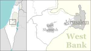
| District | Jerusalem |
| Council | Mateh Yehuda |
| Affiliation | Mishkei Herut Beitar |
| Founded | 1948 |
| Population (2017)[1] | 644 |
Ramat Raziel (Hebrew: רָמַת רָזִיאֵל, lit. Raziel Heights) is a moshav in central Israel. Located in the centre of the Jerusalem corridor, it falls under the jurisdiction of Mateh Yehuda Regional Council. In 2017 it had a population of 644.[1]
History
The village was established in 1948, and was named after David Raziel, a commander of the Irgun.
It is located on land belonging to the depopulated Palestinian village of Kasla, Jerusalem.[2]
References
- 1 2 "List of localities, in Alphabetical order" (PDF). Israel Central Bureau of Statistics. Retrieved August 26, 2018.
- ↑ Khalidi, Walid (1992). All That Remains: The Palestinian Villages Occupied and Depopulated by Israel in 1948. Washington D.C.: Institute for Palestine Studies. p. 299. ISBN 0-88728-224-5.
This article is issued from
Wikipedia.
The text is licensed under Creative Commons - Attribution - Sharealike.
Additional terms may apply for the media files.