Midland County, Michigan
| Midland County, Michigan | ||
|---|---|---|
_Courthouse.jpg) Midland County Courthouse | ||
| ||
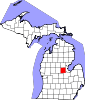 Location in the U.S. state of Michigan | ||
 Michigan's location in the U.S. | ||
| Founded | 1831, reorganized 1855[1] | |
| Seat | Midland | |
| Largest city | Midland | |
| Area | ||
| • Total | 528 sq mi (1,368 km2) | |
| • Land | 516 sq mi (1,336 km2) | |
| • Water | 12 sq mi (31 km2), 2.2% | |
| Population | ||
| • (2010) | 83,629 | |
| • Density | 162/sq mi (63/km2) | |
| Congressional district | 4th | |
| Time zone | Eastern: UTC−5/−4 | |
| Website |
www | |

Midland County is a county located in the U.S. state of Michigan. As of the 2010 census, the population was 83,629.[2] The county seat is Midland.[3] The county's name is due to its closeness to the geographical Lower Peninsula's geographical center. It was founded in 1831. However, it was not until 1855 that the county was effectively organized.[1]
Midland County comprises the Midland, MI Metropolitan Statistical Area and is included in the Saginaw-Midland-Bay City Combined Statistical Area in the Mid/Central Michigan region.
Geography
According to the U.S. Census Bureau, the county has a total area of 528 square miles (1,370 km2), of which 516 square miles (1,340 km2) is land and 12 square miles (31 km2) (2.2%) is water.[4]
Adjacent counties
- Gladwin County (north)
- Bay County (east)
- Saginaw County (southeast)
- Gratiot County (south)
- Isabella County (west)
- Clare County (northwest)
Transportation
Highways
Airports
Scheduled airline service is available from MBS International Airport[5] in Freeland, Michigan and Bishop International Airport in Flint, Michigan.[6] Midland also has a general aviation airport, Jack Barstow Municipal Airport.[7]
Public transportation
There is no regularly scheduled public transportation (bus service). Residents can call in advance to schedule pickup for transport within the county by two government sponsored agencies ("Dial-A-Ride" within the city of Midland and "County Connection" for those outside the city of Midland but still within Midland County) for a nominal fee.[8]
Demographics
| Historical population | |||
|---|---|---|---|
| Census | Pop. | %± | |
| 1850 | 65 | — | |
| 1860 | 787 | 1,110.8% | |
| 1870 | 3,285 | 317.4% | |
| 1880 | 6,893 | 109.8% | |
| 1890 | 10,657 | 54.6% | |
| 1900 | 14,439 | 35.5% | |
| 1910 | 14,005 | −3.0% | |
| 1920 | 17,237 | 23.1% | |
| 1930 | 19,150 | 11.1% | |
| 1940 | 27,094 | 41.5% | |
| 1950 | 35,662 | 31.6% | |
| 1960 | 51,450 | 44.3% | |
| 1970 | 63,769 | 23.9% | |
| 1980 | 73,578 | 15.4% | |
| 1990 | 75,651 | 2.8% | |
| 2000 | 82,874 | 9.5% | |
| 2010 | 83,629 | 0.9% | |
| Est. 2016 | 83,411 | [9] | −0.3% |
| U.S. Decennial Census[10] 1790-1960[11] 1900-1990[12] 1990-2000[13] 2010-2013[2] | |||
As of the census[14] of 2000, there were 82,874 people, 31,769 households, and 22,683 families residing in the county. The population density was 159 people per square mile (61/km²). There were 33,796 housing units at an average density of 65 per square mile (25/km²). The racial makeup of the county was 95.50% White, 1.05% Black or African American, 0.40% Native American, 1.49% Asian, 0.03% Pacific Islander, 0.44% from other races, and 1.09% from two or more races. 1.55% of the population were Hispanic or Latino of any race. 28.6% were of German, 11.5% English, 10.2% United States or American, 8.9% Irish and 6.1% Polish ancestry according to Census 2000. 96.7% spoke only English, while 1.6% spoke Spanish at home.
There were 31,769 households out of which 34.90% had children under the age of 18 living with them, 60.10% were married couples living together, 8.10% had a female householder with no husband present, and 28.60% were non-families. 23.50% of all households were made up of individuals and 9.00% had someone living alone who was 65 years of age or older. The average household size was 2.56 and the average family size was 3.04.
In the county, the population was spread out with 26.90% under the age of 18, 8.70% from 18 to 24, 29.20% from 25 to 44, 23.20% from 45 to 64, and 12.00% who were 65 years of age or older. The median age was 36 years. For every 100 females there were 96.30 males. For every 100 females age 18 and over, there were 93.30 males.
The median income for a household in the county was $45,674, and the median income for a family was $55,483. Males had a median income of $45,656 versus $27,470 for females. The per capita income for the county was $23,383. About 5.70% of families and 8.40% of the population were below the poverty line, including 9.50% of those under age 18 and 7.50% of those age 65 or over.
Religion
The Roman Catholic Diocese of Saginaw is the controlling regional body for the Catholic Church.[15]
Politics
| Year | Republican | Democratic | Third Parties |
|---|---|---|---|
| 2016 | 55.8% 23,846 | 36.6% 15,635 | 7.7% 3,295 |
| 2012 | 57.0% 23,919 | 41.6% 17,450 | 1.5% 610 |
| 2008 | 50.8% 22,263 | 47.3% 20,701 | 1.9% 834 |
| 2004 | 56.3% 24,369 | 42.4% 18,355 | 1.3% 551 |
| 2000 | 56.3% 21,887 | 41.0% 15,959 | 2.7% 1,042 |
| 1996 | 46.0% 16,547 | 42.2% 15,177 | 11.8% 4,243 |
| 1992 | 41.8% 16,149 | 34.7% 13,382 | 23.5% 9,093 |
| 1988 | 59.1% 19,994 | 39.8% 13,452 | 1.1% 371 |
| 1984 | 66.1% 21,521 | 33.1% 10,769 | 0.8% 262 |
| 1980 | 53.0% 17,828 | 35.8% 12,019 | 11.2% 3,763 |
| 1976 | 58.6% 17,631 | 39.7% 11,959 | 1.7% 511 |
| 1972 | 61.4% 16,473 | 35.4% 9,504 | 3.2% 859 |
| 1968 | 60.6% 14,329 | 31.4% 7,428 | 8.0% 1,901 |
| 1964 | 41.7% 9,020 | 58.1% 12,587 | 0.2% 48 |
| 1960 | 67.6% 14,235 | 32.3% 6,815 | 0.1% 21 |
| 1956 | 74.8% 13,207 | 25.0% 4,422 | 0.2% 33 |
| 1952 | 72.1% 10,508 | 27.1% 3,945 | 0.8% 117 |
| 1948 | 63.2% 5,811 | 34.8% 3,204 | 2.0% 181 |
| 1944 | 65.4% 6,850 | 34.1% 3,569 | 0.6% 63 |
| 1940 | 61.7% 6,269 | 37.8% 3,834 | 0.5% 54 |
| 1936 | 48.1% 3,829 | 47.1% 3,751 | 4.7% 377 |
| 1932 | 50.6% 3,791 | 47.4% 3,553 | 1.9% 145 |
| 1928 | 82.3% 4,555 | 17.4% 964 | 0.3% 19 |
| 1924 | 79.1% 4,004 | 12.3% 625 | 8.6% 434 |
| 1920 | 78.9% 4,115 | 18.4% 959 | 2.7% 143 |
| 1916 | 57.8% 2,104 | 40.0% 1,454 | 2.2% 81 |
| 1912 | 29.1% 902 | 21.6% 671 | 49.3% 1,528 |
| 1908 | 67.0% 1,987 | 29.5% 875 | 3.5% 105 |
| 1904 | 70.6% 2,107 | 25.7% 766 | 3.7% 110 |
| 1900 | 57.6% 1,784 | 39.5% 1,221 | 2.9% 90 |
| 1896 | 48.8% 1,524 | 48.3% 1,507 | 2.9% 90 |
| 1892 | 46.2% 1,069 | 35.2% 815 | 18.7% 432 |
| 1888 | 49.6% 1,336 | 42.6% 1,148 | 7.8% 210 |
| 1884 | 53.4% 1,071 | 44.0% 883 | 2.6% 53 |
Midland County predominantly supports the Republican Party, in contrast to the neighboring counties of Isabella, Saginaw, and Bay, who mainly support the Democratic Party.
Government
The county government operates the jail, maintains rural roads, operates the major local courts, keeps files of deeds and mortgages, maintains vital records, administers public health regulations, and participates with the state in the provision of welfare and other social services. The county board of commissioners controls the budget but has only limited authority to make laws or ordinances. In Michigan, most local government functions — police and fire, building and zoning, tax assessment, street maintenance, etc. — are the responsibility of individual cities and townships. Due to funding cuts, the Midland County Sheriff does not have a patrol division. Former patrol officers now serve in the Citizens Assistance Responders (CAR) division and will respond to requests for assistance.[17]
Elected officials
- Prosecuting Attorney: J. Dee Brooks
- Sheriff: Scott Stephenson
- County Clerk: Ann Manary
- County Treasurer: Cathy Lunsford
- Register of Deeds: Julie Atkinson
- Drain Commissioner: Douglas D. Enos
(information as of January 2013)
Board of Commissioners
7 members, elected from districts (7 Republicans)
| District | Commissioner | Party | Positions |
|---|---|---|---|
| 1 | Al Kloha | Republican | |
| 2 | Mark Bone | Republican | Chair of the Board |
| 3 | James Leigeb | Republican | Vice-Chair of Human Services Committee |
| 4 | Richard Keenan | Republican | Vice-Chair of Administration and Operations Committee |
| 5 | James Geisler | Republican | Chair of Administration and Operations Committee and Chair of Executive of the Whole |
| 6 | Eric Dorrien | Republican | Chair of Human Services Committee |
| 7 | Scott Noesen | Republican | Chair of Finance Committee |
Communities

Cities
Village
Townships
See also
- List of Michigan State Historic Sites in Midland County, Michigan
- National Register of Historic Places listings in Midland County, Michigan
- Midland Tomorrow, Economic Development
References
- 1 2 "Bibliography on Midland County". Clarke Historical Library, Central Michigan University. Retrieved January 20, 2013.
- 1 2 "State & County QuickFacts". United States Census Bureau. Archived from the original on July 14, 2011. Retrieved August 28, 2013.
- ↑ "Find a County". National Association of Counties. Retrieved 2011-06-07.
- ↑ "2010 Census Gazetteer Files". United States Census Bureau. August 22, 2012. Archived from the original on November 13, 2013. Retrieved September 27, 2014.
- ↑ "MBS International Airport".
- ↑ "Bishop International Airport: Flint, Michigan: Flights & Airport Travel".
- ↑ Jack Barstow Municipal Airport Archived 2010-09-03 at the Wayback Machine.
- ↑ Dial-A-Ride homepage Archived 2009-02-10 at the Wayback Machine.
- ↑ "Population and Housing Unit Estimates". Retrieved June 9, 2017.
- ↑ "U.S. Decennial Census". United States Census Bureau. Retrieved September 27, 2014.
- ↑ "Historical Census Browser". University of Virginia Library. Retrieved September 27, 2014.
- ↑ "Population of Counties by Decennial Census: 1900 to 1990". United States Census Bureau. Retrieved September 27, 2014.
- ↑ "Census 2000 PHC-T-4. Ranking Tables for Counties: 1990 and 2000" (PDF). United States Census Bureau. Retrieved September 27, 2014.
- ↑ "American FactFinder". United States Census Bureau. Retrieved 2008-01-31.
- ↑ "Diocese of Saginaw".
- ↑ http://uselectionatlas.org/RESULTS
- ↑ "Midland County Sheriff's Office" Archived 2012-01-04 at the Wayback Machine. Midland County website
External links
- Midland County web site
- Midland County Historical Society
- Midland County's Historic Bridges
- MidlandOnline
- "Bibliography on Midland County". Clarke Historical Library, Central Michigan University. Retrieved January 20, 2013.
- Midland Tomorrow web site
Places adjacent to Midland County, Michigan | ||||||||||
|---|---|---|---|---|---|---|---|---|---|---|
| ||||||||||
Municipalities and communities of Midland County, Michigan, United States | ||
|---|---|---|
| Cities | | |
| Village | ||
| Charter townships | ||
| General law townships | ||
| Footnotes | ‡This populated place also has portions in an adjacent county or counties | |
Central/Mid-Michigan including the Tri-Cities and Thumb | |||||||
|---|---|---|---|---|---|---|---|
| Central cities | |||||||
| Counties |
| ||||||
| Geography | |||||||
| Transportation | |||||||
| Economy | |||||||