Metropolitan Borough of Barnsley
| Borough of Barnsley | ||
|---|---|---|
| Metropolitan Borough | ||
| ||
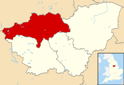 Barnsley Metropolitan Borough shown within South Yorkshire | ||
| Sovereign state | United Kingdom | |
| Constituent country | England | |
| Region | Yorkshire and the Humber | |
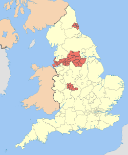
| Ceremonial county | South Yorkshire | |
| Admin. HQ | Barnsley | |
| Government | ||
| • Type | Barnsley Metropolitan Borough Council | |
| • Leadership: | Leader & Cabinet | |
| • Executive: | Labour | |
| • MPs: |
John Healey (Lab), Dan Jarvis (Lab), Stephanie Peacock (Lab), Angela Smith (Lab) | |
| Area | ||
| • Total | 127.1 sq mi (329.1 km2) | |
| Area rank | 133rd | |
| Population (mid-2017 est.) | ||
| • Total | 243,300 | |
| • Rank | Ranked 69th | |
| • Density | 1,900/sq mi (740/km2) | |
| Time zone | UTC+0 (Greenwich Mean Time) | |
| • Summer (DST) | UTC+1 (British Summer Time) | |
| ONS code |
00CC (ONS) E08000016 (GSS) | |
| Ethnicity | 97.9% White[1] | |
| Website | barnsley.gov.uk | |
The Metropolitan Borough of Barnsley is a metropolitan borough of South Yorkshire, England; its main town is Barnsley.
The borough is bisected by the M1 motorway; it is rural to the west, and largely urban/industrial to the east. 68% of Barnsley's 32,863 hectares is green belt and 9% is national park land, the majority of which is West of the M1. In 2007 it was estimated that Barnsley had 224,600 residents, measured at the 2011 census as 231,221.[2] nine tenths of whom live east of the M1.
The borough was formed under the Local Government Act 1972, by a merger of the county borough of Barnsley with Cudworth, Darfield, Darton, Dearne, Dodworth, Hoyland Nether, Penistone, Royston, Wombwell and Worsborough urban districts, along with Penistone Rural District, part of Hemsworth Rural District and part of Wortley Rural District, all in the West Riding of Yorkshire.
The borough now forms part of both the Sheffield City Region and the Leeds City Region.
Politics
Elections to the council are held in three out of every four years, with one third of the 63 councillors being elected at each election. The council had been controlled by the Labour party since the first election in 1973. As of the 2011 election the council is composed of the following councillors:-[3]
| Year | Labour | Barnsley Independent Group | Conservative | Independent |
|---|---|---|---|---|
| 2012 | 52 | 5 | 5 | 1 |
| 2015 | 55 | 4 | 4 | 0 [4] |
Following the election in 2012 the council has 53 Labour, 5 Barnsley Independent Group and 5 Conservative councillors.[3] The borough council elects the mayor every year. On the day of the election, a parade takes place in front of the town hall in honour of the new mayor.
Barnsley borough is represented by four MPs: Dan Jarvis for Barnsley Central, Angela Smith for Penistone & Stocksbridge, Stephanie Peacock for Barnsley East and John Healey for Wentworth and Dearne CC. They are all members of the Labour party.
Towns, wards and villages
- Ardsley, Athersley
- Barnsley, Barugh, Barugh-Green, Billingley, Birdwell, Bolton upon Dearne, Brierley
- Cortonwood, Carlecotes, Carlton, Cawthorne, Cubley, Cudworth
- Darfield, Darton, Dodworth, Dunford Bridge
- Elsecar
- Gawber, Gilroyd, Goldthorpe, Great Houghton, Grimethorpe
- Haigh (half in Wakefield district), Hemingfield, High Hoyland, Higham, Honeywell, Hood Green, Hoyland, Hoylandswaine
- Ingbirchworth
- Jump
- Kendray, Kexbrough, Kingstone
- Little Houghton, Lundwood
- Mapplewell, Millhouses, Millhouse Green, Monk Bretton
- New Lodge
- Old Town, Oxspring
- Platts Common, Penistone, Pilley, Pogmoor
- Royston
- Shafton, Silkstone, Silkstone Common, Smithies, Staincross, Stairfoot
- Tankersley, Thurgoland, Thurlstone, Thurnscoe
- Ward Green, Wilthorpe, Woolley Colliery, Wombwell, Wortley, Worsbrough
Education
There are over 100 schools and colleges in the borough]. State education is managed by Barnsley Local Education Authority. There are 14 state run secondary schools and around 80 primary schools. There is an independent school, Hope House School. Post 16 education is provided at Barnsley College and the Sixth Form of Penistone Grammar School. An adult education college, Northern College, is located at Wentworth Castle in Stainborough. The University of Huddersfield has a campus in Barnsley town centre.
Places of interest
Places of concern
See also
References
- ↑ https://www.barnsley.gov.uk/services/council-and-democracy/statistics-and-census-information/the-2011-census
- ↑ "Metropolitan District population 2011". Neighbourhood Statistics. Office for National Statistics. Retrieved 3 March 2016.
- 1 2 "Labour's majority up to 23 - full election results here". Barnsley Chronicle. 6 May 2011. Retrieved 22 June 2011.
- ↑ "England council results". BBC News. Retrieved 23 May 2015.