Mesquite, Texas
| Mesquite, Texas | |
|---|---|
| City | |
 AMC 30 Mesquite Texas 2016 | |
| Motto(s): Real. Texas. Flavor. | |
 Location within Dallas County and the state of Texas | |
 Mesquite Location in the United States  Mesquite Mesquite (the US) | |
| Coordinates: 32°46′58″N 96°36′36″W / 32.78278°N 96.61000°WCoordinates: 32°46′58″N 96°36′36″W / 32.78278°N 96.61000°W | |
| Country |
|
| State |
|
| Counties | Dallas, Kaufman |
| Government | |
| • Type | Council-Manager |
| • City Mayor | Stan Pickett |
| • City Manager | Cliff Keheley |
| Area | |
| • Total | 46.2 sq mi (119.6 km2) |
| • Land | 46.0 sq mi (119.2 km2) |
| • Water | 0.2 sq mi (0.4 km2) |
| Elevation | 495 ft (151 m) |
| Population (2013) | |
| • Total | 143,484 |
| • Density | 3,216/sq mi (1,241.7/km2) |
| Time zone | UTC-6 (CST) |
| • Summer (DST) | UTC-5 (CDT) |
| ZIP codes | 75149, 75150, 75181, |
| Area code(s) | 214, 469, 972 |
| FIPS code | 48-47892[1] |
| GNIS feature ID | 1341400[2] |
| Website | cityofmesquite.com |
The city of Mesquite is a suburb located east of Dallas, Texas. Most of the city is located in Dallas County. As of the 2015 census, the population was 144,788, making it the twentieth most populous city in the state of Texas.[3][4] Mesquite is positioned in the crossroads of four major highways (Interstates 30, 635, 20 and U.S. Highway 80), making locations, such as Downtown Dallas, Lake Ray Hubbard, Dallas Love Field and DFW International airports, accessible.
According to legislative action, the city is the "Rodeo Capital of Texas".[5] In 2016, Mesquite received a Playful City USA designation,[6] for the fourth year in a row.[7] The city has been named a Tree City USA by the National Arbor Day Foundation, for over 25 years.[8] The city of Mesquite holds the 10th longest reign in all of Texas.[9]
History
The city was founded on March 14, 1878, on land along the Texas & Pacific Railroad, which ran from Dallas to Shreveport, Louisiana. The locals then named the town after Mesquite Creek. The city was officially incorporated on December 3, 1887, after electing Mayor J.E. Russell.[10]
Mesquite prospered through the late 19th century and early 20th century as a farming community growing cotton, hay, corn and sugar and using the railroad to ship raw goods. The town remained predominantly agrarian until after World War II when the suburban boom also took root in Mesquite. The city's population rapidly grew:
Years before the settlers moved into the area, Mesquite was an open prairie land and a key trading ground for Indigenous peoples. The Ionies, were the western tribe located close to present day Fort Worth. The Tawakonies, were in present-day Dallas. Finally, the Caddo, were the native farmers of the Mesquite land. From 1680 to 1790, after harvest was over, these three tribes held an annual tournament and trading fair.[11]
Many outlaws resided in the area, but Sam Bass is historically known for his train robberies in Texas. In 1878 he robbed a train in downtown Mesquite, escaping with $30,000.[10]
The Mesquiter, was established in 1882 by R.S. Kimbrough, and was Dallas County's longest running newspaper.[10]
In 1946, the Mesquite Rodeo was founded by CC AKA Charlie Columbus McNally, and was one of the only rodeos that had a permanent location. By the mid 1980s, the events were being broadcast by ESPN.[12]
In 1959, Big Town Mall opened as the first air conditioned shopping mall in the United States. The mall was demolished in the summer of 2006.
By 1970, LBJ Freeway (I-635) was constructed, connecting Mesquite to its neighbors, Garland to the north and Balch Springs to the south. Also in 1971, Town East Mall was constructed. The mall was used by director Ron Howard to film portions of the movie Cotton Candy in 1978. The mall's associated traffic and shops would continue to grow the town. By the 1990 census, the city had grown to 101,484 people, nearly twice the population twenty years earlier.
In 1986, the Mesquite Arena opened its doors as the new home for the Mesquite ProRodeo. By 1998, the facility was expanded to include a Convention Center, Exhibition Hall and a Hampton Inn & Suites.
2011 saw Mesquite pass a law that allows beer and wine sales in the city. The measure had been considered several times for many years, but was always blocked by strong protest against the proposed sales. It was one of the few cities without beer and wine sales in eastern Dallas County before the law came into effect.
In June 2015, the Mesquite Arts Center added on a Freedom Park exhibit, in memorial of September 11. The park displays a 15-foot beam that was recovered from the remains of Ground Zero. Mesquite Fire Department received the beam in 2011.[13]
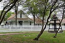
Historic Mesquite Inc. (HMI)
Historic Mesquite Inc., is a 501(c)(3) nonprofit organization, organized for the charitable and educational purposes of identifying and preserving historic structures, identifying and securing historic designations for properties, and providing the public with the tools to navigate Mesquite history and culture.[14][15]
Facilities
Mesquite Arts Center
The 36,700-square-foot municipal arts facility houses a 494-seat music performance hall, a black box theater, a rehearsal hall, galleries and support space.[16] The facility serves as the cultural center for the community and is home to the Mesquite Community Theatre, Mesquite Community Band and the Mesquite Symphony Orchestra.[17]
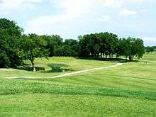
Mesquite Golf Club
Mesquite Golf Club is a 154-acre, 18-hole golf course for both novice and expert golfers. Operated by the City of Mesquite, the course is open 7 days a week and features a pro shop and driving range.[18]
Parks and recreation
The city houses 76 parks and 4 recreation centers. The city has been designated a Playful City USA four years running and opened its Heritage Trail system in 2015.[19] The hike and bike trail system consists of 4.25 miles of concrete trails and sidewalks, three trailheads and other improvements that connect residents from their homes to the Mesquite Golf Club, schools, recreation centers, sports fields, shopping and more.[20]
Mesquite Public Libraries
In 2016, the Mesquite Public Library System was presented with a 2016 Achievement of Library Excellence Award by the Texas Municipal Library Directors Association. Of the 548 public library systems in Texas, the Mesquite Public Library was one of only 43 libraries to earn this prestigious honor.[21] The Mesquite Public Library System] consists of two branches to serve the community. Both branches offer traditional and non-traditional programs.[22]
Business parks
- Skyline Business Park
- High Point Industrial Park
- Forney Road Industrial District
- Skyline Trade Center
- Peachtree Center
Geography
Mesquite is located at 32°46′58″N 96°36′36″W / 32.782878°N 96.609862°W (32.782878, -96.609862).[23]
According to the United States Census Bureau, the city has a total area of 46.2 square miles (119.6 km2), of which 46.0 square miles (119.2 km2) is land and 0.15 square miles (0.4 km2), or 0.33%, is water.[24]
Places adjacent to Mesquite, Texas | |
|---|---|
| Mesquite, Texas | ||||||||||||||||||||||||||||||||||||||||||||||||||||||||||||
|---|---|---|---|---|---|---|---|---|---|---|---|---|---|---|---|---|---|---|---|---|---|---|---|---|---|---|---|---|---|---|---|---|---|---|---|---|---|---|---|---|---|---|---|---|---|---|---|---|---|---|---|---|---|---|---|---|---|---|---|---|
| Climate chart (explanation) | ||||||||||||||||||||||||||||||||||||||||||||||||||||||||||||
| ||||||||||||||||||||||||||||||||||||||||||||||||||||||||||||
| ||||||||||||||||||||||||||||||||||||||||||||||||||||||||||||
Climate
On average, the warmest month is July. The highest recorded temperature was 112 °F in 1980. The average coolest month is January. The lowest recorded temperature was 1 °F in 1989.
May is the average wettest month. Mesquite is part of the humid subtropical region.
Government
Local government
The City Council consists of a Mayor and six Councilmembers.[25]
Stan Pickett, Mayor Robert Miklos, Place 1 Jeff Casper, Deputy Mayor Pro Tem, Place 2 Bruce Archer, Mayor Pro Tem, Place 3 Dan Aleman, Place 4 Greg Noschese, Place 5 Tandy Boroughs, Place 6 Cliff Keheley, City Manager
Education
Public schools
Mesquite Independent School District provides primary and secondary (K-12) education to most areas of Mesquite. A small portion of Mesquite is served by Dallas Independent School District. While another small area in Kaufman County is within the Forney Independent School District, the section has no residents. Mesquite also serves an area of Balch Springs.
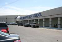
In addition to 33 public elementary schools and 9 public middle schools, Mesquite is served by 5 high schools: Mesquite High School, North Mesquite High School, West Mesquite High School, Poteet High School, and Horn High School.
| Name | Year Founded | Size | Mascot | Principal |
|---|---|---|---|---|
| Mesquite High School | 1901 | 6A | Stormy the Skeeter | Kevin Samples |
| North Mesquite High School | 1969 | 6A | Stallion | Doug Barber |
| West Mesquite High School | 1976 (as middle school initially) | 5A | Wrangler | Alesia Austin |
| Poteet High School | 1986 | 5A | Pirate | Taylor Morris |
| John Horn High School | 2000 | 6A | Jaguar | Bruce Perkins |
Private schools
Dallas Christian School is located in Mesquite.
Colleges and universities
Higher education is provided by three institutions. Eastfield College provides undergraduate degrees and continuing education credits as part of the Dallas County Community College District. The Texas A&M University–Commerce Mesquite Metroplex Center provides graduate-level courses and degrees in a variety of fields. Columbia College-Mesquite Campus is located on the Eastfield College campus. It is a private, nonprofit institution that was founded in Columbia, Missouri, in 1851. It provides bachelor's and master's degree programs.
Transportation
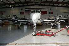
Mesquite is served by a publicly owned and operated airport, Mesquite Metro Airport.[26] The airport includes a 6,000-foot (1,800 m) lighted runway with ILS. General aviation comprises approximately 75% of daily operations, while commercial aviation comprises the rest.[27] Mesquite Metro Airport is popular among transient aircraft due to its location near Dallas and favorable fuel prices.[28]
Two other nearby airports, Dallas/Fort Worth International Airport and Dallas Love Field, provide regular commercial passenger service to the region. Love Field is approximately 15 miles (24 km) from Mesquite; DFW Airport is approximately 30 miles (48 km) from Mesquite.
Mesquite is not a member of Dallas Area Rapid Transit, but on April 12, 2011 The DART Board changed its policy to permit DART to contract with non-member cities for services, such as passenger rail and express service. The city and DART staffs have developed a coordinated plan to have a weekday commuter service in operation between the Hanby Stadium visitor parking lot and the DART's Green Line Lawnview Station. This route opened March 12, 2012. The city also operates its own paratransit service for elderly and disabled residents.[29]
Union Pacific Railroad operates an intermodal facility for its freight rail service as part of the Skyline Industrial Park. The recent expansion of this intermodal facility won a Silver award in the Industrial Paving Category by the American Concrete Pavement Association.[30]
Highways
Mesquite is served by three interstate highways, one US highway, and one state highway. Interstates 20, 30, and 635, US Highway 80, and Texas State Highway 352 all pass through Mesquite. Belt Line Road also passes through Mesquite and serves as a major road.
Demographics
| Historical population | |||
|---|---|---|---|
| Census | Pop. | %± | |
| 1890 | 135 | — | |
| 1900 | 406 | 200.7% | |
| 1910 | 687 | 69.2% | |
| 1920 | 674 | −1.9% | |
| 1930 | 729 | 8.2% | |
| 1940 | 1,045 | 43.3% | |
| 1950 | 1,696 | 62.3% | |
| 1960 | 27,526 | 1,523.0% | |
| 1970 | 55,131 | 100.3% | |
| 1980 | 67,053 | 21.6% | |
| 1990 | 101,484 | 51.3% | |
| 2000 | 124,523 | 22.7% | |
| 2010 | 139,824 | 12.3% | |
| Est. 2017 | 143,949 | [31] | 3.0% |
| U.S. Decennial Census[32] | |||
As of the 2010 Census:
- Total population: 139,824
- Total households: 48,390
- Total families: 35,444
- Population density: 3,216 people/mi2 (1,241.7/km2)
- Housing density: 1,129.4/mi2 (435.8/mi2)
- Racial makeup:
- 59.0% White (41.6% non-Hispanic White)
- 21.8% African American
- 0.84% Native American
- 3.24% Asian
- 0.07% Pacific Islander
- 3.12% two or more races
- 31.6% Hispanic or Latino origin[4]
There were 48,390 households in the city, out of which 39.1% had children under the age of 18 living with them, 48.3% were headed by married couples living together, 18.9% had a female householder with no husband present, and 26.8% were non-families. 22.4% of all households were made up of individuals, and 6.4% were someone living alone who was 65 years of age or older. The average household size was 2.88, and the average family size was 3.38.[4]
In the city, 29.8% of the population were under the age of 18, 10.1% were 18 to 24 years old, 27.9% were 25 to 44, 23.7% were 45 to 64, and 8.6% were 65 years of age or older. The median age was 32.3 years. For every 100 females, there were 91.3 males. For every 100 females age 18 and over, there were 86.4 males.[4]
As of the 2000 Census:
- Per capita income: $20,890
- Median household income: $30,424
- Median family income: $36,357
- Median income (males): $37,756
- Median income (females): $29,905
About 5.0% of families and 6.8% of the population were below the poverty line, including 8.8% of those under age 18 and 6.6% of those age 65 or over.
Mesquite has a group of Indian Americans, mostly Kerala-origin Indian Christians.[33] Their settlement, one of the earliest of the Indian Americans in the DFW area, was influenced by proximity to Dallas-based hospitals such as Baylor University Medical Center at Dallas and Parkland Hospital as well as having initial low income and difficulties moving to mostly-white northern suburbs.[34]
Economy
According to the City's 2008 Comprehensive Annual Financial Report,[35] the top employers in the city are:
| # | Employer | # of Employees | % of Total City Employment |
|---|---|---|---|
| 1 | United Parcel Service Inc. | 3,000 | 4.22% |
| 2 | Dallas Regional Medical Center | 1,150 | 1.62% |
| 3 | City of Mesquite | 1,054 | 1.48% |
| 4 | Sears | 450 | 0.63% |
| 5 | Texas Dept of Transportation - Dallas District | 425 | 0.60% |
| 6 | Baker Drywall LTD | 400 | 0.56% |
| 7 | Dallas County Community College | 400 | 0.56% |
| 8 | Christian Care Center | 400 | 0.56% |
| 9 | Integra Color | 383 | 0.54% |
| 10 | Pepsi-Cola Metro Bottling Co Inc | 325 | 0.46% |
Neighborhoods
Neighborhoods include:
- Lawson
- Samuell Farms
- Meadow Creek
- Parkview
- Broadmoor Estates
- Old Broadmoor Estates
- Crooked Lane
- Fuentes
- Edgemont Park
- Creek Crossing
- Creek Crossing II
- Falcon's Lair
- Falcon's Ridge
- Pecan Creek
- Rollingwood Hills
- Skyline
- Pasadena Gardens
- Original Town
- Melton
- Tealwood
- Northridge
- Quail Hollow
- Wildwood
- Valley Creek
- Meadowview
- Palos Verdes
- Mesquite Park
Constructions
- Mesquite Tower is a lattice tower of unusual design.
- Town East Tower is the tallest inhabited building in Mesquite, standing seven stories high.
Notable people
- Dave Abruzzese, ex-drummer for Pearl Jam
- Quincy Acy, professional basketball player for Brooklyn Nets and New York Knicks
- Melissa Archer, actress on One Life to Live
- Craig Wayne Boyd, winner of Season 7 of NBC's The Voice
- Tarell Brown, professional football player for New England Patriots, played for San Francisco 49ers, Oakland Raiders and for Texas Longhorns 2005 National Championship team; graduate of North Mesquite High School
- Trevone Boykin, quarterback for Texas Christian University and NFL's Seattle Seahawks
- Joe Bowden, former professional football player for Houston Oilers, Tennessee Titans, and Dallas Cowboys
- John D. Carmack, game programmer and co-founder of id Software[36] Lead programmer of the id computer games Wolfenstein 3D, Doom, Quake, their sequels and the Commander Keen series of games and is the current the CTO of Oculus VR.
- Ray Cunningham, former professional baseball player for St. Louis Cardinals
- Alyssa Edwards, drag performer and dance instructor; competed on Season 5 of RuPaul's Drag Race and Season 2 RuPaul's Drag Race: All Stars
- Terry Fator, singer and ventriloquist, winner of America's Got Talent in 2007[37]
- Taylor Gabriel, professional football player for Chicago Bears
- Don Gay, eight-time PRCA world champion bullrider
- Todd Graham, college football coach; head coach at Arizona State
- Jerry Hall, actress and model, former wife of Mick Jagger and mother of four of his children
- Jason Jennings, Major League Baseball player for Colorado Rockies, Texas Rangers
- Micah Xavier Johnson, former soldier of United States Army Reserves and perpetrator of 2016 shooting of Dallas police officers
- Vivian Le, figure skater
- Taylor Lipsett, gold medalist in sled hockey at 2010 Winter Paralympic Games in Vancouver; he led Team USA in goals, with 5 goals in 5 games, and added 2 assists for a total of 7 points
- Sean Lowe, MLB player for Chicago White Sox, St. Louis Cardinals, Pittsburgh Pirates, Colorado Rockies, and Kansas City Royals
- Damien Magnifico, MLB player for Los Angeles Angels, Milwaukee Brewers
- Bryan Massey, actor and writer
- Taylor Parks, actress and singer, best known as Little Inez in 2007 film Hairspray[38]
- Greg Vaughan, actor on General Hospital
See also

References
- ↑ "American FactFinder". United States Census Bureau. Retrieved 2008-01-31.
- ↑ "US Board on Geographic Names". United States Geological Survey. 2007-10-25. Retrieved 2008-01-31.
- ↑ "U.S. Census Bureau QuickFacts: Mesquite city, Texas; UNITED STATES". Census Bureau QuickFacts. Retrieved 2 October 2018.
- 1 2 3 4 "Profile of General Population and Housing Characteristics: 2010 Demographic Profile Data (DP-1): Mesquite city, Texas". U.S. Census Bureau, American Factfinder. Retrieved January 13, 2012.
- ↑ "Mesquite Championship Rodeo | The Rodeo Capital of Texas". Mesquitechampionshiprodeo.com. Retrieved 2017-01-27.
- ↑ "Playful City USA Communities - KaBOOM!". Kaboom.org. Retrieved 2 October 2018.
- ↑ "Playful City USA | Mesquite, TX - Official Website". Cityofmesquite.com. Retrieved 2017-02-03.
- ↑ "Tree City USA - The Arbor Day Foundation". Arborday.org. Retrieved 2 October 2018.
- ↑ "Mesquite Recognized As A Tree City USA". Retrieved 2017-04-14.
- 1 2 3 SUSANNE, STARLING, (2010-06-15). "MESQUITE, TX". Tshaonline.org. Archived from the original on 2011-07-15. Retrieved 2017-01-27.
- ↑ A Stake in the Prairie: Mesquite, Texas (Mesquite Historical Committee, 1984). Mesquite, Tx: Mesquite Historical Committee. 1984. pp. 7–10.
- ↑ "History of The Mesquite ProRodeo | Mesquite Championship Rodeo". Mesquitechampionshiprodeo.com. Retrieved 2017-01-27.
- ↑ "Mesquite will host Freedom Park, 9/11 memorial | Garland | Dallas News". Dallas News. 2015-06-10. Retrieved 2017-01-27.
- ↑ "Historic Mesquite, Inc. | Mesquite, TX - Official Website". Cityofmesquite.com. Retrieved 2017-04-14.
- ↑ "Historic Mesquite Inc." Exempt Organizations Select Check. Internal Revenue Service. Retrieved January 29, 2018.
- ↑ "Mesquite Arts Center - Mesquite, TX - Official Website". Cityofmesquite.com. Retrieved 2 October 2018.
- ↑ "Mesquite Arts Center | Mesquite, TX - Official Website". Cityofmesquite.com. Retrieved 2017-04-14.
- ↑ "Mesquite Golf Club". Mesquitegc.com. Retrieved 2017-04-14.
- ↑ "Trails - Mesquite, TX - Official Website". Cityofmesquite.com. Retrieved 2 October 2018.
- ↑ "Mesquite will host Freedom Park, 9/11 memorial | Garland | Dallas News". Dallas News. 2015-06-10. Retrieved 2017-01-27.
- ↑ report, staff. "Mesquite Public Library earns 2016 Achievement of Library Excellence Award". Star Local. Retrieved 2017-04-14.
- ↑ "MESQUITE PUBLIC LIBRARY SYSTEM - Mesquite, TX - Official Website". Cityofmesquite.com. Retrieved 2 October 2018.
- ↑ "US Gazetteer files: 2010, 2000, and 1990". United States Census Bureau. 2011-02-12. Retrieved 2011-04-23.
- ↑ "Geographic Identifiers: 2010 Demographic Profile Data (G001): Mesquite city, Texas". U.S. Census Bureau, American Factfinder. Retrieved January 13, 2012.
- ↑ City of Mesquite AFR Archived 2010-11-21 at the Wayback Machine. Retrieved 2009-08-17
- ↑ City of Mesquite web site. Access 10 September 2006
- ↑ "Archived copy". Archived from the original on 2006-09-01. Retrieved 2006-09-09. City of Mesquite web site. Accessed 9 September 2006
- ↑ AirNav: Mesquite Metro Airport. Accessed 8 September 2006
- ↑ City of Mesquite web site. Accessed 9 September 2006
- ↑ "TranSystems - Mesquite Intermodal Facility Expansion Receives Recognition". Transystems.com. Retrieved 3 October 2017.
- ↑ "Population and Housing Unit Estimates". Retrieved June 9, 2017.
- ↑ "Census of Population and Housing". Census.gov. Retrieved June 4, 2015.
- ↑ Brettell, Caroline B. '"Big D" Incorporating New Immigrants in a Sunbelt Suburban Metropolis' (Chapter 3). In: Singer, Audrey, Susan Wiley Hardwick, and Caroline Brettell. Twenty-First Century Gateways: Immigrant Incorporation in Suburban America (James A. Johnson metro series). Brookings Institution Press, 2009. ISBN 0815779283, 9780815779285. Start p. 53. CITED: p.64.
- ↑ Brettell, Caroline B. '"Big D" Incorporating New Immigrants in a Sunbelt Suburban Metropolis' (Chapter 3). In: Singer, Audrey, Susan Wiley Hardwick, and Caroline Brettell. Twenty-First Century Gateways: Immigrant Incorporation in Suburban America (James A. Johnson metro series). Brookings Institution Press, 2009. ISBN 0815779283, 9780815779285. Start p. 53. CITED: p.65.
- ↑ City of Mesquite CAFR Archived 2010-11-21 at the Wayback Machine. Retrieved 2009-08-17
- ↑ Biography for John Carmack on IMDb
- ↑ "Archived copy". Archived from the original on 2007-09-28. Retrieved 2007-07-05. Cedar Creek Pilot article
- ↑ "Hairspray - Scholastic.com". 2.scholastic.com. Retrieved 3 October 2017.
External links
- Official website
- Mesquite from the Handbook of Texas Online
| Wikimedia Commons has media related to Mesquite, Texas. |
Municipalities and communities of Dallas County, Texas, United States | ||
|---|---|---|
| Cities | 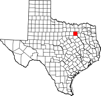 | |
| Towns | ||
| Unincorporated communities | ||
| Historical communities | ||
| Footnotes | ‡This populated place also has portions in an adjacent county or counties | |
Municipalities and communities of Kaufman County, Texas, United States | ||
|---|---|---|
| Cities | 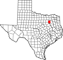 | |
| Towns | ||
| Villages | ||
| CDPs | ||
| Unincorporated communities | ||
| Footnotes | ‡This populated place also has portions in an adjacent county or counties | |

Mayors of cities with populations exceeding 100,000 in Texas | ||
|---|---|---|
| ||