Manuk
| Manuk | |
|---|---|
| Highest point | |
| Elevation | 282 m (925 ft) [1] |
| Coordinates | 5°32′38″S 130°18′19″E / 5.5439°S 130.3054°ECoordinates: 5°32′38″S 130°18′19″E / 5.5439°S 130.3054°E |
| Geography | |
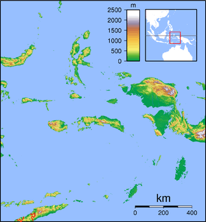
| Location | Banda Sea, Indonesia |
| Geology | |
| Mountain type | Stratovolcano |
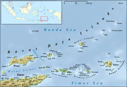
Manuk Island in the north east of the Barat Daya Islands
Manuk is an uninhabited volcanic island located in the Banda Sea, Indonesia. Administratively it is part of the Maluku Tengah Regency, Maluku Province.[2]
Manuk means bird in various Austronesian languages.
Mount Manuk
Mount Manuk is a truncated andesitic volcano on Manuk Island. Rising 3,000 m from the sea floor, it is the easternmost volcano of the Banda Arc chain that forms a volcanic island. No confirmed historical eruptions are known from Manuk.[1]
See also
References
- 1 2 "Manuk". Global Volcanism Program. Smithsonian Institution. Retrieved 2006-12-29.
- ↑ Maluku Tengah Regency
This article is issued from
Wikipedia.
The text is licensed under Creative Commons - Attribution - Sharealike.
Additional terms may apply for the media files.