Makian
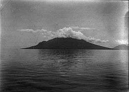 Makian Island in 1903 | |
 | |
| Geography | |
|---|---|
| Location | Southeast Asia |
| Archipelago | Maluku Islands |
| Highest elevation | 1,357 m (4,452 ft) |
| Administration | |
|
Indonesia | |
| Province | North Maluku |
| Additional information | |
| Time zone | |
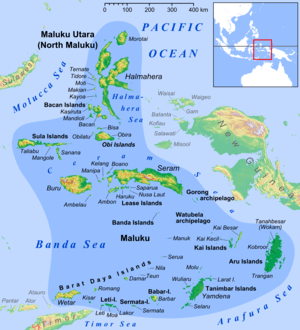
Makian (also Machian and Pulau Makian, where pulau means 'island') is a volcanic island, one of the Maluku Islands within the province of North Maluku in Indonesia. It lies near the southern end of a chain of volcanic islands off the western coast of Halmaherato (Halmahera region), to the south of Tidore and to the north of Kayoa and Bacan.[1]
The island is 10 kilometres (6 miles) wide, and its 1,357-metre (4,452-foot) high summit consists of a large 1.5 kilometres (1 mile) wide crater, with a small lake on its Northeast side.[2] There are four parasitic cones on the western slopes of Makian. Makian volcano is also known as Mount Kiebesi (or Kie Besi).
Volcanic history
Makian volcano has had infrequent, but violent eruptions that destroyed villages on the island.
Its first recorded eruption was in the 1550s.[3] The eruptions of July 19, 1646, September 22, 1760 and December 28, 1861 are rated 4 in the Smithsonian National Museum of Natural History Global Volcanism Program's Large Volcano Explocivity Index.[4] Since the first known eruption in the 1550s, it has erupted seven times, four of which caused fatalities.[5]
The 1760 eruption of the volcano killed about three thousand inhabitants. It erupted in 1890, and was then dormant until July 1988, when a series of eruptions forced the temporary evacuation of the island's entire population, then about fifteen thousand people.[6]
See also
References
- ↑ "Makian island, geographic location, administrative division and map". Retrieved April 5, 2013. .
- ↑ "Description and photo of Makian island". Retrieved April 5, 2013. .
- ↑ "Makian". Global Volcanism Program. Smithsonian Institution.
- ↑ "Large Volcano Explocivity (sic) Index". AllCountries.org. May 10, 2010. Retrieved April 4, 2013. .
- ↑ Smithsonian Institution / SEAN (1989). Lindsay McClelland; Tom Simkin; Marjorie Summers; Elizabeth Nielsen; Thomas C. Stein, eds. Global Volcanism 1975–1985. Prentice Hall, Englewood Cliffs NJ, and American Geophysical Union, Washington DC. p. 232. ISBN 0-13-357203-X.
- ↑ Volcano erupts on evacuated island. United Press International July 30, 1988.
External links

- (in English) (in Dutch) Makian As It Appears from the Side of Ngofakiaha from 1670