Madanpur, India
| Madanpur | |
|---|---|
| Census Town | |
 Madanpur Location in West Bengal, India  Madanpur Madanpur (India) | |
| Coordinates: 23°01′N 88°29′E / 23.02°N 88.48°ECoordinates: 23°01′N 88°29′E / 23.02°N 88.48°E | |
| Country |
|
| State | West Bengal |
| District | Nadia |
| Elevation | 9 m (30 ft) |
| Population (2011) | |
| • Total | 13,675 |
| Languages | |
| • Official | Bengali, English |
| Time zone | UTC+5:30 (IST) |
| PIN | 741245 |
| Vehicle registration | WB |
| Website |
nadia |
Madanpur is a census town (Chakdaha CD Block) in Kalyani subdivision of Nadia district in the Indian state of West Bengal.[1] It is located around 53 km away from Kolkata - the capital of West Bengal. Madanpur has been transformed rapidly from a village to a suburb/census town in last 15 years. Madanpur is famous for cultivation of cauliflowers all over Bengal.
History
In the middle of eighteenth century when the railway was yet to come in Bengal, this area was full of grass land and lash green on the bank of Ganges river. The current station area was totally in the river bed. After 1750 it became populated. The myth was that Thakur Madangopal with Sri Radha used to take rest at this place on the way to Krishnanagar via Chandirampur. The people of the village was very much happy with this and they started worshiping Lord Madangopal. From then, people started calling this place as 'Madanpur' which means place for Madangopal. Here we still have Madangopal temple near Birohi.[2]
Geography
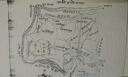
Madanpur is located at 23°01′N 88°29′E / 23.02°N 88.48°E.[3] It has an average elevation of 9 m (30 ft). It is situated on the bank of Ganges which is called Hoogly River in this place. Madanpur is full of highly fertile agricultural land. It is spread till Kaliganj in the North, Ishwaripur in the West, Birohi in the East and Kalyani in the South. Madanpur has wide marsh area. Yamuna river, a feeder of Ganges flows through Madanpur to meet Ichhamoti. The source place of Yamuna river is called Tribeni. But, nowadays this river is almost in dying condition. The nearest Bangladesh border (Petrapole) is just about 51 km from Madanpur.
Most of the areas are full of lash green with various types of flora.
Demographics
As per the 2011 Census of India, Madanpur had a total population of 13,675, of which 6,993 (51%) were males and 6,682 (49%) were females. Population below 6 years was 1,062. The total number of literates in Madanpur was 11,823 (93.74% of the population over 6 years).[4]
As of 2001 India census Madanpur had a population of 12,029. Males constitute 52% of the population and females 48%. Madanpur has an average literacy rate of 81%, higher than the national average of 59.5%: male literacy is 85%, and female literacy is 76%. In Madanpur, 9% of the population is under 6 years of age.[5]
Transport
Madanpur station is on the Sealdah-Ranaghat Line of the Kolkata Suburban Railway. Rickshaws, Auto-rickshaws and Totos are used for local conveyance. National Highway 34 (India) is passed over the Birohi near Madanpur.
Education
There are three Higher secondary school; Alaipur Manorama Siksha Niketan(H.S) co- ed, Madanpur Kendriya Adarsha Vidyalaya (H.S) for Girl's and Madanpur Kendriya Adarsha Vidyalaya (H.S) for Boy's.
Those schools are run by the state government. Bengali is the primary language of instruction. Schools follow the "10+2" plan. There are several Primary Schools also.
Attractions of Madanpur
- Temple of Madangopal (Lord Krishna) - Birohi, besides 34 National Highway, 6 km away from Madanpur Railway Station.
- Birla Family Laxmi narayan Mandir
- Sayantani More Kali Mandir - Near Sarkar Bag Centre.
- Saheb Bagan - Old forest area developed by British officers, presently a picnic spot
- Kali Mandir - Near Sayantani More
- House of Bengali actor Bikash Roy near Kaliganj, Madanpur.[2]
- Alaipur 'Jamunapara' - a natural picnic spot and Kali Maa Mandir
- Dil Park - a family picnic spot near Iswaripur village
- Gouranga Mandir , at Gouranga para.
Financial Services
There are nationalized banks, cooperatives and micro financing institutions supporting the agrarian economy of the region. However, unorganized money lenders dominant the financing needs of the small traders in urgent need of money. There are two major banks :
- State Bank of India (Near Indira More)
- United Bank of India (Near Indira More)
- Six ATM Counters.
References
- ↑ "District Wise List of Statutory Towns". Census of India 2011, Urban Frame. Directorate of Census Operations, West Bengal. Archived from the original on 2007-09-27. Retrieved 2015-08-03.
- 1 2 Bibartaner Dharay Madanpur (Bengali). Tarulata Prakashani. 1999. p. 4.
- ↑ Falling Rain Genomics, Inc - Madanpur
- ↑ "2011 Census – Primary Census Abstract Data Tables". West Bengal – District-wise. Registrar General and Census Commissioner, India. Retrieved 18 May 2017.
- ↑ "Census of India 2001: Data from the 2001 Census, including cities, villages and towns (Provisional)". Census Commission of India. Archived from the original on 2004-06-16. Retrieved 2008-11-01.
Cities, towns and locations in Nadia District | |||||||||
|---|---|---|---|---|---|---|---|---|---|
| Cities, municipal and census towns |
| ||||||||
| Locations other than cities and towns |
| ||||||||
| Related topics |
| ||||||||