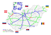
M3 motorway (Hungary)
| |
|---|---|
| M3 autópálya | |
 | |
| Route information | |
|
Part of | |
| Length |
281 km (175 mi) 307 km (191 mi) planned |
| Major junctions | |
| From | Budapest |
|
| |
| To |
Barabás |
| Location | |
| Counties | Pest, Heves, Borsod-Abaúj-Zemplén, Hajdú-Bihar, Szabolcs-Szatmár-Bereg |
| Major cities | Budapest, Hatvan, Gyöngyös, Füzesabony, Polgár, Nyíregyháza |
| Highway system | |
_Otszogletu_kek_tabla.svg.png)
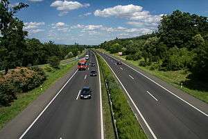


The M3 motorway (Hungarian: M3-as autópálya) is a Hungarian motorway connecting Budapest to Nyíregyháza. It will eventually connect Budapest to the Ukrainian border. Two other motorways branch off it, the M30 (connecting the M3 to Miskolc) and the M35 (connecting the M3 to Debrecen). The M3 follows the route of route 3, and, later, route 4. The section of the motorway, the one between Görbeháza and Nyíregyháza was opened to the public in August 2007. The latest section of the motorway, the one between Highway 49 and Vásárosnamény was opened to the public in 2014.[1] The total length of the motorway now is 281 km.
Municipalities
The M3 motorway runs through the following municipalities:
- Budapest, Fót, Mogyoród, Szada, Gödöllő, Domony, Bag, Hévízgyörk, Galgahévíz
- Kerekharaszt, Hatvan, Hort, Ecséd, Atkár, Gyöngyöshalász, Karácsond, Nagyfüged, Ludas, Nagyút, Kompolt, Kál, Füzesabony, Szihalom, Mezőszemere
- Mezőkövesd, Mezőkeresztes, Mezőnagymihály, Gelej, Csincse, Emőd, Mezőcsát, Igrici, Hejőpapi, Nemesbikk, Hejőkürt, Oszlár
- Polgár, Folyás, Görbeháza, Hajdúböszörmény, Hajdúnánás, Hajdúdorog
- Kálmánháza, Nyíregyháza, Nagykálló, Napkor, Kállósemjén, Magy, Pócspetri, Ófehértó, Kántorjánosi, Őr, Papos, Nyírparasznya, Vásárosnamény
Openings timeline
- Budapest – Gödöllő (14 km): 1978.10.16.
- Gödöllő – Hatvan (29 km): 1980.10.31.
- Hatvan – Gyöngyös-west (15 km): 1983
- Gyöngyös-west – Füzesabony (44 km): 1998.09.01.
- Füzesabony – Polgár (61 km): 2002
- Polgár – Görbeháza; M35 (11 km): 2004.10.
- Görbeháza; M35 – Nyíregyháza (41 km): 2007.08.31.
- Nyíregyháza bypass (8 km): 2006.08.05.
- Nagykálló – Őr (33,8 km): 2013.01.16.
- Őr – Vásárosnamény (11,9 km): 2014.10.10.
Junctions, exits and rest area
- Distance from Zero Kilometre Stone (Adam Clark Square) in Budapest in kilometres.
| Budapest – Beregdaróc (307 km) | ||||
| 10 km | Budapest-Rákospalota | |||
| 11 km | Bp.-Újplaota / Bp.-Újpest | |||
| 12 km | Szilas rest area | |||
| Dunakeszi, Vác | ||||
| 13 km | Hegyeshalom, Letenye, Pécs, Röszke Budapest International Airport | Budapest bypass | ||
| 18 km | Hungaroring, Aquaréna | 301 | ||
| Ring rest area | ||||
| 23 km | Mogyoród / Szada | 2101 | ||
| 25 km | Jakabpuszta rest area | |||
| 27 km | M0 connection | Transit road to M0 | ||
| Vác / Gödöllő | 2104 | |||
| 32 km | Babati rest area |
|||
| 36 km | Kisbagi rest area | |||
| 39 km | Bag, Tura / Aszód | 3105 | ||
| 43 km | Galga rest area | |||
| 51 km | Kerekharaszt | 2134 | ||
| Kerekharaszti rest area | ||||
| 55 km | Hatvan west / Salgótarján, Somoskőújfalu | |||
| 59 km | Hatvan east / Szolnok | Hatvan bypass | ||
| 60 km | Horti rest area | |||
| 66 km | Ecsédi rest area | |||
| 70 km | Gyöngyös west / Hort | |||
| 75 km | Halászaranyosi rest area | |||
| 78 km | Gyöngyös east, Mátrafüred / Adács | 3210 | ||
| 82 km | Borsókúti rest area | |||
| 87 km | Nagyfügedi rest area | |||
| 90 km | Nagyfüged, Heves / Ludas | 3206 | ||
| 92 km | Kisasszonytéri rest area | |||
| 103 km | Kál / Erdőtelek | 3208 | ||
| 104 km | Railway Line 102 (Kál-Kápolna-Kisújszállás) | |||
| 106 km | Rekettyés rest area | |||
| 114 km | Füzesabony, Eger / Tiszafüred | |||
| 122 km | Mezőszemerei rest area | |||
| 128 km | Mezőkövesd / Borsodivánka | 3302 | ||
| 139 km | Mezőnagymihály / Mezőkeresztes | 3305 | ||
| 142 km | Geleji rest area | |||
| 151 km | Miskolc, Tornyosnémeti | M30 turns toward -> | ||
| 153 km | Igrici rest area | |||
| 156 km | Mezőcsát / Hejőpapi | 3307 | ||
| 164 km | Hejőkürt / Tiszaújváros | 3313 | ||
| 169 km | Tisza River | Bridge - 405.5 m | ||
| 171 km | Polgári rest area | |||
| 175 km | Nyékládháza, Polgár / Görbeháza | M3 Outlet Center | ||
| M3 Arcehopark | ||||
| 179 km | Western Main Channel | Bridge - 93 m | ||
| 184 km | Görbeháza rest area | |||
| 187 km | Hajdúböszörmény, Debrecen, Berettyóújfalu | M35 turns toward -> | ||
| 194 km | Rétaljai rest area | |||
| 200 km | Eastern Main Channel | |||
| 203 km | Hajdúnánás / Tiszavasvári | 3502 | ||
| 206 km | Hajdúnánási rest area | |||
| 215 km | Kálmánházi rest area | |||
| 221 km | Nyíregyháza west, Tokaj | Nyíregyháza west bypass | ||
| 227 km | Nyíregyháza south / Újfehértó | |||
| 229 km | Nyíregyházi rest area | |||
| 234 km | Nyíregyháza east / Nagykálló | 4911 | ||
| Nyíregyháza north, Kisvárda | Nyíregyháza east bypass | |||
| 244 km | ||||
| 254 km | Nyírbátor / Ófehértó, Baktalórántháza | 4105 | ||
| 263 km | Kántorjánosi rest area | |||
| 267 km | Őr, Rohod / Mátészalka | |||
| 280 km | Vásárosnamény | |||
Toll
From February 1, 2015, the M3 motorway is fully charged. The motorway can be used instead of the national sticker with the following county stickers:
| Type of vignette | Available section |
|---|---|
| Pest County | between Szentmihályi Street junction and Hatvan west (11 km – 55 km) |
| Heves County | between Bag and Mezőkövesd (39 km – 128 km) |
| Borsod-Abaúj-Zemplén County | between Füzesabony and Polgár (114 km – 175 km) |
| Hajdú-Bihar County | between Hejőkürt and Nyíregyháza west (164 km – 221 km) |
| Szabolcs-Szatmár-Bereg County | between Hajdúnánás and Vásárosnamény (203 km – 280 km) |
Significant artifacts
From Budapest to the Ukrainian border, the M3 motorway features the following bridges, tunnels or covered cuts:
- Bridge
- Tisza Bridge of Polgár (Polgári Tisza-híd; 405.5 m or 1,330 ft) over Tisza river
- Landscape history memorial park
- M3 Arcehopark – Open-air museum near this motorway
- Outlet center
- M3 Outlet Center
European Route(s)
| Name | Route | |
| 124 km | ||
| 36 km | ||
| 7 km | ||
See also
References
External links
| Wikimedia Commons has media related to Autópálya M3. |
- National Toll Payment Services Plc. (in Hungarian, some information also in English)
- National Infrastructure Developer Ltd. (in Hungarian)
- Exit list of M3 in motorways-exitlists.com