Tiszavasvári
| Tiszavasvári | ||
|---|---|---|
| ||
| Country |
| |
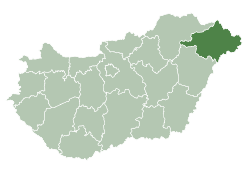
| County | Szabolcs-Szatmár-Bereg | |
| Area | ||
| • Total | 126.59 km2 (48.88 sq mi) | |
| Population (2005) | ||
| • Total | 13,473 | |
| • Density | 107.3/km2 (278/sq mi) | |
| Time zone | UTC+1 (CET) | |
| • Summer (DST) | UTC+2 (CEST) | |
| Postal code | 4440 | |
| Area code(s) | 42 | |

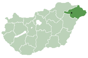
Location of Szabolcs-Szatmar-Bereg county in Hungary
Tiszavasvári is a town in Szabolcs-Szatmár-Bereg county, in the Northern Great Plain region of eastern Hungary.
History
The settlement of Tiszavasvári was created in 1941 by merging the former independent settlements of Tiszabűd and Szentmihály under the name of Bűdszentmihály. The villagers of Tiszabűd opposed the merger and the two communities were separated in 1946 but only for four years. In 1950 the two settlements were again merged. The name of the locality was changed to Tiszavasvári in 1952 in memory of Pál Vasvári, a Hungarian writer and participant in the Hungarian Revolution of 1848.
Geography
It covers an area of 126.59 km2 (49 sq mi) and has a population of 13,473 people (2005).
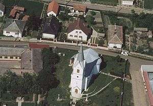
Aerialphotography of Tiszavasvári
Sister cities


References
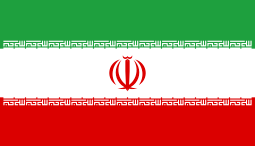
- ↑ "Pact of pariahs forming between Iran and Hungary's Jobbik". Retrieved 24 May 2015.
This article is issued from
Wikipedia.
The text is licensed under Creative Commons - Attribution - Sharealike.
Additional terms may apply for the media files.