Lohsa
| Lohsa/Łaz | ||
|---|---|---|
| ||
 Lohsa/Łaz Location of Lohsa/Łaz within Bautzen district 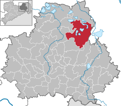  | ||
| Coordinates: 51°23′2″N 14°24′12″E / 51.38389°N 14.40333°ECoordinates: 51°23′2″N 14°24′12″E / 51.38389°N 14.40333°E | ||
| Country | Germany | |
| State | Saxony | |
| District | Bautzen | |
| Government | ||
| • Mayor | Thomas Leberecht (CDU) | |
| Area | ||
| • Total | 134.36 km2 (51.88 sq mi) | |
| Elevation | 114 m (374 ft) | |
| Population (2017-12-31)[1] | ||
| • Total | 5,292 | |
| • Density | 39/km2 (100/sq mi) | |
| Time zone | CET/CEST (UTC+1/+2) | |
| Postal codes | 02999 | |
| Dialling codes | 035724/035726 | |
| Vehicle registration | BZ | |
| Website | Einheitsgemeinde Lohsa | |

Lohsa (Sorbian: Łaz) is a municipality (German: Einheitsgemeinde) in the district of Bautzen, in Saxony, Germany.
The municipality is part of the recognized Sorbian settlement area in Saxony. Upper Sorbian has an official status next to German, all villages bear names in both languages.
 Municipal building in Lohsa
 Church in Lohsa
 School in Lohsa
 Castle in Weißig, district of Lohsa
Villages
Several villages belong to the municipality:
- Dreiweibern (Sorbian: Tři Žony)
- Driewitz (Drěwcy)
- Friedersdorf (Bjedrichecy)
- Groß Särchen (Wulke Ždźary)
- Hermsdorf/Spree (Hermanecy)
- Koblenz (Koblicy)
- Lippen (Lipiny)
- Litschen (Złyčin)
- Lohsa (Łaz)
- Mortka (Mortkow)
- Riegel (Roholń)
- Steinitz (Šćeńca)
- Tiegling (Tyhelc)
- Weißig (Wysoka)
- Weißkollm (Běły Chołmc)
References
- ↑ "Aktuelle Einwohnerzahlen nach Gemeinden 2017] (Einwohnerzahlen auf Grundlage des Zensus 2011)" (PDF). Statistisches Landesamt des Freistaates Sachsen (in German). October 2018.
External links

This article is issued from
Wikipedia.
The text is licensed under Creative Commons - Attribution - Sharealike.
Additional terms may apply for the media files.