Großharthau
| Großharthau | |
|---|---|
 Großharthau Location of Großharthau within Bautzen district 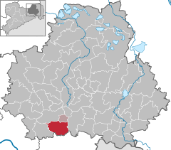  | |
| Coordinates: 51°07′N 14°06′E / 51.117°N 14.100°ECoordinates: 51°07′N 14°06′E / 51.117°N 14.100°E | |
| Country | Germany |
| State | Saxony |
| District | Bautzen |
| Municipal assoc. | Großharthau |
| Government | |
| • Mayor | Jens Krauße (SPD) |
| Area | |
| • Total | 37.27 km2 (14.39 sq mi) |
| Elevation | 270 m (890 ft) |
| Population (2017-12-31)[1] | |
| • Total | 2,710 |
| • Density | 73/km2 (190/sq mi) |
| Time zone | CET/CEST (UTC+1/+2) |
| Postal codes | 01909 |
| Dialling codes | 035954, 035200 Seeligstadt |
| Vehicle registration | BZ |
| Website | www.grossharthau.de |
Großharthau is a municipality in the east of Saxony, Germany. It belongs to the district of Bautzen and lies southwest of the eponymous city.
Geography
The municipality is situated at the northern edge of the Lausitzer Bergland (Lusatian Hills), near Bischofswerda.
Villages
Several villages belong to the municipality:
- Großharthau
- Bühlau
- Schmiedefeld
- Seeligstadt
References
- ↑ "Aktuelle Einwohnerzahlen nach Gemeinden 2017] (Einwohnerzahlen auf Grundlage des Zensus 2011)" (PDF). Statistisches Landesamt des Freistaates Sachsen (in German). October 2018.
This article is issued from
Wikipedia.
The text is licensed under Creative Commons - Attribution - Sharealike.
Additional terms may apply for the media files.