Bautzen (district)
| Bautzen Wokrjes Budyšin | |
|---|---|
| District | |
 | |
| Country |
|
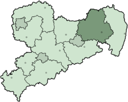
| State | Saxony |
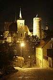
| Capital | Bautzen |
| Area | |
| • Total | 2,390.7 km2 (923.1 sq mi) |
| Population (31 December 2017)[1] | |
| • Total | 302,634 |
| • Density | 130/km2 (330/sq mi) |
| Time zone | UTC+01:00 (CET) |
| • Summer (DST) | UTC+02:00 (CEST) |
| Vehicle registration | BZ, BIW, HY, KM |
| Website |
www |
The district of Bautzen (German: 'Landkreis Bautzen', Upper Sorbian: 'Wokrjes Budyšin') is a district in the state of Saxony in Germany. Its largest towns are Bautzen, Bischofswerda, Kamenz, Hoyerswerda and Radeberg. It is the biggest district in Saxony in area, and is a member of the Neisse Euroregion.
It is bordered to the south by the Czech Republic. Clockwise, it also borders the district of Sächsische Schweiz-Osterzgebirge, the district-free city of Dresden, the district of Meißen, the state of Brandenburg, and Görlitz district
History
Historically most of the Upper Lusatia belonged to Bohemia. After the end of the Thirty Years' War it became a part of Saxony. Only the small town of Schirgiswalde remained Bohemian until 1809.
The district was established in 1994 by merging the former districts of Bautzen and Bischofswerda. The district of Kamenz and the district-free city of Hoyerswerda were merged into the district in August 2008.
Geography
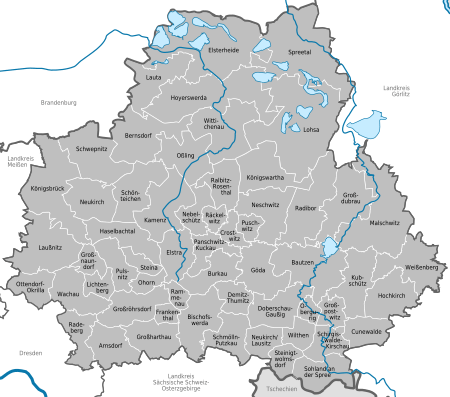
The district of Bautzen is part of the region of Upper Lusatia (Oberlausitz). The south of the district is occupied by the Lusatian Mountains, and the countryside slopes away to the north.
The Spree river enters the district from the southeast and runs through Schirgiswalde and Bautzen before leaving to the north. North of Bautzen, the river is dammed by a reservoir (Talsperre Bautzen, 5.5 km²).
At its widest, the district is 65 km east-west, and 63 km north-south.
Towns and municipalities
Coat of arms
 |
The district's arms are identical to the arms of the margravate of Upper Lusatia. The coat of arms was established about 1350, when six towns of Upper Lusatia founded a confederacy. This loose alliance became a margravate under the Bohemian crown in 1378. |
References
- ↑ "Aktuelle Einwohnerzahlen nach Gemeinden 2017] (Einwohnerzahlen auf Grundlage des Zensus 2011)" (PDF). Statistisches Landesamt des Freistaates Sachsen (in German). October 2018.
External links
![]()
- Official website (German)
| Urban districts | |
|---|---|
| Rural districts | |
| Former urban districts | |
| Former rural districts | |
Coordinates: 51°17′N 14°16′E / 51.283°N 14.267°E
| Authority control |
|---|