Königswartha
| Königswartha/Rakecy | ||
|---|---|---|
 | ||
| ||
 Königswartha/Rakecy Location of Königswartha/Rakecy within Bautzen district 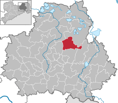  | ||
| Coordinates: 51°19′N 14°20′E / 51.317°N 14.333°ECoordinates: 51°19′N 14°20′E / 51.317°N 14.333°E | ||
| Country | Germany | |
| State | Saxony | |
| District | Bautzen | |
| Government | ||
| • Mayor | Georg Paschke (CDU) | |
| Area | ||
| • Total | 47.04 km2 (18.16 sq mi) | |
| Elevation | 141 m (463 ft) | |
| Population (2017-12-31)[1] | ||
| • Total | 3,473 | |
| • Density | 74/km2 (190/sq mi) | |
| Time zone | CET/CEST (UTC+1/+2) | |
| Postal codes | 02699 | |
| Dialling codes | 035931 | |
| Vehicle registration | BZ | |
| Website | www.koenigswartha.net | |

Königswartha, in Sorbian Rakecy, is a municipality in the east of Saxony, Germany. It belongs to the district of Bautzen and lies 20 km north of the eponymous city.
The municipality is part of the recognized Sorbian settlement area in Saxony. Upper Sorbian has an official status next to German, all villages bear names in both languages.
"Rakecy" means "men of the cancer". The village was mentioned the first time in 1350.
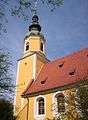 Church in Königswartha
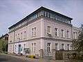 Town hall
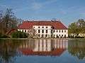 Castle of Königswartha
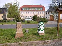
 Old house in Königswartha
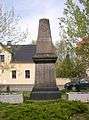 War memorial
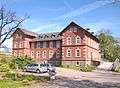 Rest home
Geography
The municipality is situated in the Upper Lusatian flatland. The village stretches along the river Schwarzwasser.
Villages
Several villages belong to the municipality:
- Caminau (Kamjenej)
- Commerau (Komorow)
- Entenschenke (Kača Korčma)
- Eutrich (Jitk)
- Johnsdorf (Jeńšecy)
- Königswartha (Rakecy)
- Neudorf (Nowa Wjes)
- Niesendorf (Niža Wjes)
- Oppitz (Psowje)
- Truppen (Trupin)
- Wartha (Stróža)
References
- ↑ "Aktuelle Einwohnerzahlen nach Gemeinden 2017] (Einwohnerzahlen auf Grundlage des Zensus 2011)" (PDF). Statistisches Landesamt des Freistaates Sachsen (in German). October 2018.
This article is issued from
Wikipedia.
The text is licensed under Creative Commons - Attribution - Sharealike.
Additional terms may apply for the media files.