Letterbreckaun
| Letterbreckaun | |
|---|---|
| Irish: Binn Bhriocáin; Brecan's peak | |
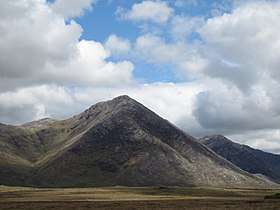 Letterbreckaun as seen from the Inagh Valley looking southeastwards along the central section of the Maumturks range, with Knocknahillion in the background | |
| Highest point | |
| Elevation | 667 m (2,188 ft) [1] |
| Prominence | 322 m (1,056 ft) [1] |
| Listing | Hewitt, Marilyn |
| Coordinates | 53°32′01″N 9°43′31″W / 53.533551°N 9.725249°WCoordinates: 53°32′01″N 9°43′31″W / 53.533551°N 9.725249°W |
| Geography | |
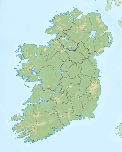 Letterbreckaun Location in Ireland | |
| Location | Galway, Ireland |
| Parent range | Maumturks |
| OSI/OSNI grid | L856550 |
Letterbreckaun (Irish: Binn Bhriocáin; Brecan's peak)[2] is a 667-metre (2,188 ft) mountain in the Maumturks range in Connemara, Ireland. It is a quartize peak, and the second tallest mountain in the Maumturks range, positioned at the northen edge of its central ridge section.[1]
The anglicised name of Letterbreckaun comes from Irish: Leitir Bhriocáin, or "Brecan’s wet hillside", and is the name of a townland on the slope of the hill. Saint Brecan is a saint associated particularly with Co. Galway, who is said to have been the successor to St. Enda in Cill Éinne, the Aran Islands.[2]
See also
References
- 1 2 3 MountainViews.ie
- 1 2 Paul Tempan (February 2012). "Irish Hill and Mountain Names" (PDF). MountainViews.ie.
External links
- The Maamturks Challenge, University College Galway Mountaineering Club
- The Maamturks Challenge: Routecard (2015)
- Mountainviews: Letterbreckaun

This article is issued from
Wikipedia.
The text is licensed under Creative Commons - Attribution - Sharealike.
Additional terms may apply for the media files.