Binn Mhór
| Binn Mhór | |
|---|---|
| Irish: Binn Mhór; great peak | |
 Binn Mhór | |
| Highest point | |
| Elevation | 661 m (2,169 ft) [1] |
| Prominence | 406 m (1,332 ft) [1] |
| Listing | Marilyn |
| Coordinates | 53°29′00″N 9°37′48″W / 53.483292°N 9.630018°WCoordinates: 53°29′00″N 9°37′48″W / 53.483292°N 9.630018°W |
| Naming | |
| Translation | Great peak (Irish) |
| Geography | |
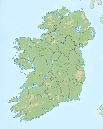 Binn Mhór Location in Ireland | |
| Location | Galway, Ireland |
| Parent range | Maumturks |
| OSI/OSNI grid | L918493 |
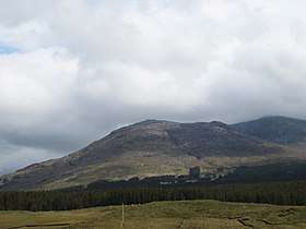
Binn Mhór (Irish: Binn Mhór; great peak)[2] is a 661-metre (2,169 ft) mountain in the Maumturks range in Connemara, Ireland. It is a quartize peak, and the third tallest mountain in the Maumturks range, positioned in the southern section.[1]
Binn Mhór lies to the southeast of the deep mountain pass that cuts through the Maumturks range, called Irish: Máméan, a site of pilgrimage dedicated to Saint Patrick.[3] Climbers completing the "Maamturks Challenge", a walk covering the entire 25-kilometre Muamturk range in a single day,[4] need to descend from Binn Mhor, at 661 metres, all the way down to Irish: Máméan, at 150 metres, and then re-ascend back up to Binn Chaonaigh, at 633 metres.
See also
References
- 1 2 3 MountainViews.ie
- ↑ Paul Tempan (February 2012). "Irish Hill and Mountain Names" (PDF). MountainViews.ie.
- ↑ "Máméan Pilgrimage". National Museum of Ireland.
High up the slopes of the Maum Turk Mountains in Connemara there is a natural passage-way known as Máméan (pass of the birds). At the summit of this rugged track you will find an ancient pilgrim site dedicated to St. Patrick.
- ↑ "The Maumturks Challenge". University College Galway Mountaineering Club. 2018.
External links
- The Maamturks Challenge, University College Galway Mountaineering Club
- The Maamturks Challenge: Routecard (2015)
- Mountainviews: Binn Mhor

This article is issued from
Wikipedia.
The text is licensed under Creative Commons - Attribution - Sharealike.
Additional terms may apply for the media files.