Corcogemore
| Corcogemore | |
|---|---|
|
Corcóg; Cone or Beehive | |
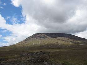 Corcogemore from the R336 | |
| Highest point | |
| Elevation | 609 m (1,998 ft) [1] |
| Prominence | 221 m (725 ft) [1] |
| Listing | Marilyn |
| Coordinates | 53°28′56″N 9°34′43″W / 53.482115°N 9.578483°WCoordinates: 53°28′56″N 9°34′43″W / 53.482115°N 9.578483°W |
| Geography | |
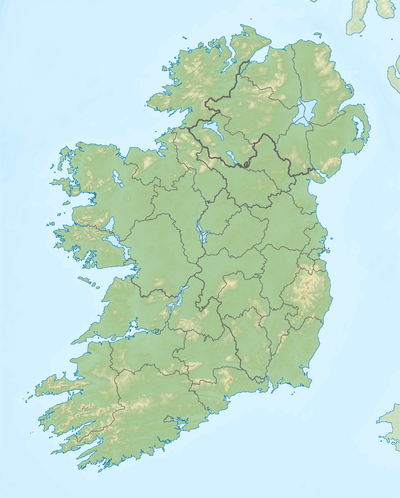 Corcogemore Location in Ireland | |
| Location | Galway, Ireland |
| Parent range | Maumturks |
| OSI/OSNI grid | L952491 |
Corcogemore or Corcoge More (Irish: Corcóg; Cone or Beehive)[2] is a 609-metre (1,998 ft) mountain in the Maumturks range in Connemara, Ireland. It is the first major summit on the annual "Maamturks Challenge", a walk covering the entire 25-kilometre range of the Maumturks range in a single day.[3]
Corcogemore lies at the bottom southeast end of the Maumturks range, being the most southerly summit and also the second most easterly in the Maamturks area.[1] The R336 passes between Corcogemore and Lackavrea, providing access to both mountains.[1] Cartographer Tim Robinson notes: "the Ordnance Survey has been incorrectly calling this mountain 'Leckavrea' for a hundred and fifty years." Leckavrea (Ir. Leic Aimhréidh) is a mountain to the east.[2]
See also
References
- 1 2 3 4 MountainViews.ie
- 1 2 Paul Tempan (February 2012). "Irish Hill and Mountain Names" (PDF). MountainViews.ie.
- ↑ "The Maumturks Challenge". University College Galway Mountaineering Club. 2018.
External links
- The Maamturks Challenge, University College Galway Mountaineering Club
- The Maamturks Challenge: Routecard (2015)
- Mountainviews: Corcogemore
