Leicester, New York
| Leicester | |
|---|---|
| Town | |
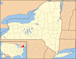 Leicester Location within the state of New York | |
| Coordinates: 42°46′17″N 077°53′45″W / 42.77139°N 77.89583°WCoordinates: 42°46′17″N 077°53′45″W / 42.77139°N 77.89583°W | |
| Country | United States |
| State | New York |
| County | Livingston |
| Government | |
| • Type | Town Council |
| • Town Supervisor | Gary D. Moore (D, R) |
| • Town Council |
Members' List
|
| Area[1] | |
| • Total | 33.93 sq mi (87.89 km2) |
| • Land | 33.93 sq mi (87.88 km2) |
| • Water | 0.00 sq mi (0.01 km2) |
| Population (2010) | |
| • Total | 2,200 |
| • Estimate (2016)[2] | 2,139 |
| • Density | 63.04/sq mi (24.34/km2) |
| Time zone | UTC-5 (Eastern (EST)) |
| • Summer (DST) | UTC-4 (EDT) |
| FIPS code | 36-051-41883 |
Leicester /ˈlɛstər/ LES-tər is a town in Livingston County, New York, United States. The population was 2,200 at the 2010 census. The town is named after Leicester Phelps, an early inhabitant.[3]
The Town of Leicester is on the west border of the county. The town has a village also named Leicester within itself. Leicester is west of Geneseo.
History
The area was a major stronghold of the Seneca tribe until the American Revolution with three major villages: Little Beard's Town, Big Tree, and Squakie Hill. These three settlements were a target of the Sullivan Expedition in 1779, to end raids on American communities.
The town was first settled around 1789. The town was formed in 1802, but the name, originally spelled "Lester" or "Leister," was changed in 1805 to the current form. The town was later reduced in size by the creation of newer towns: Mount Morris (1813) and York (1819).
The Coverdale Cobblestone House was added to the National Register of Historic Places in 2005.[4]
Geography
According to the United States Census Bureau, the town has a total area of 33.5 square miles (86.8 km²), of which, 33.5 square miles (86.8 km²) of it is land and 0.03% is water.
The Genesee River forms the eastern border of the town, and the west town line is the border of Wyoming County.
The concurrent routes of U.S. Route 20A and New York State Route 39 form an east-west highway across the town from Pine Tavern to the eastern town line. West of Pine Tavern, US 20A and NY 39 follow separate roadways to the western town line. New York State Route 36 is a north-south highway, intersecting US-20A and NY-39 at Leicester village.
Demographics
| Historical population | |||
|---|---|---|---|
| Census | Pop. | %± | |
| 1820 | 1,331 | — | |
| 1830 | 2,042 | 53.4% | |
| 1840 | 2,415 | 18.3% | |
| 1850 | 2,142 | −11.3% | |
| 1860 | 2,008 | −6.3% | |
| 1870 | 1,744 | −13.1% | |
| 1880 | 1,670 | −4.2% | |
| 1890 | 1,647 | −1.4% | |
| 1900 | 1,415 | −14.1% | |
| 1910 | 1,702 | 20.3% | |
| 1920 | 1,686 | −0.9% | |
| 1930 | 1,565 | −7.2% | |
| 1940 | 1,371 | −12.4% | |
| 1950 | 1,350 | −1.5% | |
| 1960 | 1,392 | 3.1% | |
| 1970 | 1,799 | 29.2% | |
| 1980 | 1,888 | 4.9% | |
| 1990 | 2,223 | 17.7% | |
| 2000 | 2,287 | 2.9% | |
| 2010 | 2,200 | −3.8% | |
| Est. 2016 | 2,139 | [2] | −2.8% |
| U.S. Decennial Census[5] | |||
As of the census[6] of 2000, there were 2,287 people, 849 households, and 640 families residing in the town. The population density was 68.2 people per square mile (26.3/km²). There were 900 housing units at an average density of 26.8 per square mile (10.4/km²). The racial makeup of the town was 97.86% White, 0.87% Black or African American, 0.09% Native American, 0.04% Asian, 0.48% from other races, and 0.66% from two or more races. Hispanic or Latino of any race were 1.01% of the population.
There were 849 households out of which 34.9% had children under the age of 18 living with them, 60.3% were married couples living together, 9.5% had a female householder with no husband present, and 24.5% were non-families. 20.0% of all households were made up of individuals and 8.0% had someone living alone who was 65 years of age or older. The average household size was 2.66 and the average family size was 3.04.
In the town, the population was spread out with 26.3% under the age of 18, 7.4% from 18 to 24, 29.5% from 25 to 44, 23.6% from 45 to 64, and 13.2% who were 65 years of age or older. The median age was 37 years. For every 100 females, there were 103.8 males. For every 100 females age 18 and over, there were 102.0 males.
The median income for a household in the town was $41,230, and the median income for a family was $46,652. Males had a median income of $35,450 versus $26,420 for females. The per capita income for the town was $17,655. About 4.6% of families and 8.2% of the population were below the poverty line, including 7.3% of those under age 18 and 4.4% of those age 65 or over.
Education
Students who reside in the Town of Leicester typically attend York Central School. Students living on the borders of Leicester could also attend the schools of bordering towns including Geneseo, Perry and Mt. Morris.
Notable people
- George W. Patterson, US congressman[7]
Communities and locations in the Town of Leicester
- Beards Creek – A tributary of the Genesee River, named after a native leader "Little Beard."
- Big Tree – Former native community and later a reservation partly in the town.
- Cuylerville – A hamlet northeast of Leicester village on Routes 20A and NY-39.
- Gibonville – A former community in the southwest part of the town.
- Leicester – The Village of Leicester is centrally located in the town on US-20A at the junction with NY-36.
- Letchworth State Park – A state park at the south town line.
- Little Beard's Town – A former native community located near present-day Cuylerville.
- Pine Tavern Corners or Pine Tavern – A hamlet southwest of Leicester village on Routes 20A and 39.
- Squakie Hill – Former native community and (later) a former reservation at the Genesee River west of NY-36.
- Teed Corners – A hamlet near the north town line on NY-36.
See also
References
- ↑ "2016 U.S. Gazetteer Files". United States Census Bureau. Retrieved Jul 5, 2017.
- 1 2 "Population and Housing Unit Estimates". Retrieved June 9, 2017.
- ↑ Gannett, Henry (1905). The Origin of Certain Place Names in the United States. U.S. Government Printing Office. p. 184.
- ↑ National Park Service (2009-03-13). "National Register Information System". National Register of Historic Places. National Park Service.
- ↑ "Census of Population and Housing". Census.gov. Retrieved June 4, 2015.
- ↑ "American FactFinder". United States Census Bureau. Retrieved 2008-01-31.
- ↑ "PATTERSON, George Washington, (1799 - 1879)". Biographical Directory of the United States Congress. Retrieved January 14, 2014.
External links
| Wikimedia Commons has media related to Leicester, New York. |
Municipalities and communities of Livingston County, New York, United States | ||
|---|---|---|
| Towns | 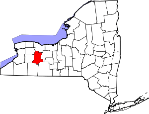 | |
| Villages | ||
| CDPs | ||
| Other hamlet | ||