Livonia Center, New York
| Livonia Center, New York | |
|---|---|
| Hamlet | |
 Livonia Center, New York  Livonia Center, New York | |
| Coordinates: 42°49′17″N 77°38′19″W / 42.82139°N 77.63861°WCoordinates: 42°49′17″N 77°38′19″W / 42.82139°N 77.63861°W | |
| Country | United States |
| State | New York |
| County | Livingston |
| Area[1] | |
| • Total | 0.817 sq mi (2.12 km2) |
| • Land | 0.817 sq mi (2.12 km2) |
| • Water | 0 sq mi (0 km2) |
| Elevation | 1,086 ft (331 m) |
| Population (2010)[1] | |
| • Total | 421 |
| • Density | 520/sq mi (200/km2) |
| Time zone | UTC-5 (Eastern (EST)) |
| • Summer (DST) | UTC-4 (EDT) |
| ZIP code | 14488 |
| Area code(s) | 585 |
| GNIS feature ID | 955755[2] |
Livonia Center is a hamlet and census-designated place in Livingston County, New York, United States. Its population was 421 as of the 2010 census.[1] Livonia Center has a post office with ZIP code 14488, which opened on April 9, 1811.[3][4] U.S. Route 20A passes through the community.
Geography
According to the U.S. Census Bureau, the community has an area of 0.817 square miles (2.12 km2), all of it land.[1]
References
- 1 2 3 4 "2010 Census Gazetteer Files - Places: New York". U.S. Census Bureau. Retrieved April 6, 2017.
- ↑ "Livonia Center". Geographic Names Information System. United States Geological Survey.
- ↑ United States Postal Service. "USPS - Look Up a ZIP Code". Retrieved April 6, 2017.
- ↑ "Postmaster Finder - Post Offices by ZIP Code". United States Postal Service. Retrieved April 6, 2017.
Municipalities and communities of Livingston County, New York, United States | ||
|---|---|---|
| Towns | 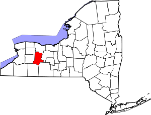 | |
| Villages | ||
| CDPs | ||
| Other hamlet | ||
This article is issued from
Wikipedia.
The text is licensed under Creative Commons - Attribution - Sharealike.
Additional terms may apply for the media files.