Fowlerville, Livingston County, New York
| Fowlerville | |
|---|---|
| hamlet & CDP | |
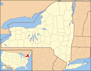 Fowlerville Location within the state of New York | |
| Coordinates: 42°53′36″N 077°50′44″W / 42.89333°N 77.84556°WCoordinates: 42°53′36″N 077°50′44″W / 42.89333°N 77.84556°W[1] | |
| Country | United States |
| State | New York |
| County | Livingston County |
| Town | Town of York |
| Area (2010 Census)[2] | |
| • Total | 0.901 sq mi (2.33 km2) |
| • Land | 0.901 sq mi (2.33 km2) |
| • Water | 0.0 sq mi (0 km2) |
| Elevation[1] | 636 ft (194 m) |
| Population (2010)[3] | |
| • Total | 227 |
| • Density | 251.9/sq mi (97.3/km2) |
| Time zone | UTC-5 (Eastern (EST)) |
| • Summer (DST) | UTC-4 (EDT) |
| Area code | 585 |
| FIPS code[1] | 36-27133 |
| GNIS feature ID[1] | 950550 |
Fowlerville is a hamlet in the Town of York in Livingston County, New York, United States.[1] The population was 227 at the 2010 census, which lists the community as a census-designated place.[3]
Fowlerville is named for Wells Fowler, the first settler.[4]
This should not be confused with other New York hamlets named Fowlerville in Erie County[5] and Sullivan County,[6] or with the similarly named hamlet of Fowlersville in Lewis County[7]
Geography
Fowlerville is located at 42°53′36″N 077°50′44″W / 42.89333°N 77.84556°W (42.8933955, -77.8455608) and its elevation is 636 feet (194 m).[1]
According to the 2010 United States Census, the CDP has a total area of 0.901 square miles (2.33 km2), all of which is land.[2]
References
- 1 2 3 4 5 6 "Fowlerville (Livingston County, NY)". Geographic Names Information System. United States Geological Survey. Retrieved January 13, 2013.
- 1 2
"Places: New York". 2010 Census Gazetteer Files. United States Census Bureau. Retrieved January 13, 2013. External link in
|work=(help) - 1 2 "Fowlerville CDP, New York". Profile of General Population and Housing Characteristics: 2010 Demographic Profile Data. United States Census Bureau. Retrieved January 13, 2013.
- ↑ Gannett, Henry (1905). The Origin of Certain Place Names in the United States. Govt. Print. Off. p. 130.
- ↑ "Fowlerville (Erie County, NY)". Geographic Names Information System. United States Geological Survey. Retrieved January 13, 2013.
- ↑ "Fowlerville (Sullivan County, NY)". Geographic Names Information System. United States Geological Survey. Retrieved January 13, 2013.
- ↑ "Fowlersville (Lewis County, NY)". Geographic Names Information System. United States Geological Survey. Retrieved January 13, 2013.
Municipalities and communities of Livingston County, New York, United States | ||
|---|---|---|
| Towns | 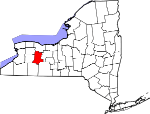 | |
| Villages | ||
| CDPs | ||
| Other hamlet | ||
This article is issued from
Wikipedia.
The text is licensed under Creative Commons - Attribution - Sharealike.
Additional terms may apply for the media files.