Cuylerville, New York
| Cuylerville | |
|---|---|
| Hamlet & CDP | |
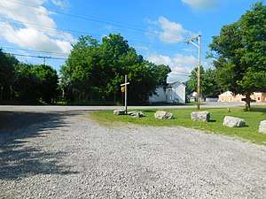 The hamlet of Cuylerville as seen from the site of the former Pennsylvania Railroad station. | |
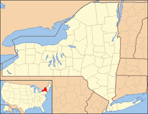 Cuylerville Location within the state of New York | |
| Coordinates: 42°46′37″N 077°52′15″W / 42.77694°N 77.87083°WCoordinates: 42°46′37″N 077°52′15″W / 42.77694°N 77.87083°W[1] | |
| Country | United States |
| State | New York |
| County | Livingston County |
| Town | Town of Leicester |
| Area (2010 Census)[2] | |
| • Total | 0.421 sq mi (1.09 km2) |
| • Land | 0.421 sq mi (1.09 km2) |
| • Water | 0.000 sq mi (0.00 km2) |
| Elevation[1] | 571 ft (174 m) |
| Population (2010)[3] | |
| • Total | 297 |
| • Density | 705/sq mi (272/km2) |
| Time zone | UTC-5 (Eastern (EST)) |
| • Summer (DST) | UTC-4 (EDT) |
| ZIP code[4] | 14481 |
| Area code | 585 |
| FIPS code[2][5] | 36-19510 |
| GNIS feature ID[5] | 947974 |
Cuylerville is a hamlet in the Town of Leicester, in Livingston County, New York, United States. The population was 297 at the 2010 census, which lists the community as a census-designated place.[3]
History
The community was named for W. T. Cuyler, an early settler.[6] The hamlet is located on the site of Little Beard's Town, a large Seneca Indian village destroyed in the Sullivan Campaign. Mary Jemison, known as "the White Woman of the Genesee", lived here.[7] The National Hotel was added to the National Register of Historic Places in 2004.[8] Located near Cuylerville is the Boyd & Parker Park and Groveland Ambuscade, listed on the National Register of Historic Places in 2009.[9]
Geography
Chenango Bridge is located at 42°46′37″N 077°52′15″W / 42.77694°N 77.87083°W (42.7770068, -77.8708370) and its elevation is 571 feet (174 m).[1]
According to the 2010 United States Census, Chenango Bridge has a total area of 0.421 square miles (1.09 km2), all of which is land.[2]
References
- 1 2 3 "Cuylerville". Geographic Names Information System. United States Geological Survey. Retrieved January 13, 2013.
- 1 2 3
"Places: New York". 2010 Census Gazetteer Files. United States Census Bureau. Archived from the original on February 17, 2013. Retrieved January 13, 2013. External link in
|work=(help) - 1 2 "Cuylerville CDP, New York". Profile of General Population and Housing Characteristics: 2010 Demographic Profile Data. United States Census Bureau. Retrieved January 13, 2013.
- ↑ "Post Offices By County: Livingston County, New York". United States Postal Service. Retrieved January 13, 2013.
- 1 2
"FIPS55 Data: New York". FIPS55 Data. United States Geological Survey. February 23, 2006. Archived from the original on October 19, 2006. External link in
|work=(help) - ↑ Gannett, Henry (1905). The Origin of Certain Place Names in the United States. Govt. Print. Off. p. 98.
- ↑ Who Was Who in America, Historical Volume, 1607-1896. Chicago: Marquis Who's Who. 1963.
- ↑ National Park Service (March 13, 2009). "National Register Information System". National Register of Historic Places. National Park Service.
- ↑ "National Register of Historic Places". WEEKLY LIST OF ACTIONS TAKEN ON PROPERTIES: 11/09/09 THROUGH 11/13/09. National Park Service. 2009-11-20.
External links
| Wikimedia Commons has media related to Cuylerville, New York. |
Municipalities and communities of Livingston County, New York, United States | ||
|---|---|---|
| Towns | 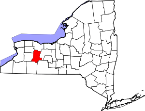 | |
| Villages | ||
| CDPs | ||
| Other hamlet | ||