Groveland Station, New York
| Groveland Station, New York | |
|---|---|
| Unincorporated community | |
 Groveland Station, New York  Groveland Station, New York | |
| Coordinates: 42°39′48″N 77°46′00″W / 42.66333°N 77.76667°WCoordinates: 42°39′48″N 77°46′00″W / 42.66333°N 77.76667°W | |
| Country | United States |
| State | New York |
| County | Livingston |
| Area[1] | |
| • Total | 0.586 sq mi (1.52 km2) |
| • Land | 0.586 sq mi (1.52 km2) |
| • Water | 0 sq mi (0 km2) |
| Elevation | 633 ft (193 m) |
| Population (2010)[1] | |
| • Total | 281 |
| • Density | 480/sq mi (190/km2) |
| Time zone | UTC-5 (Eastern (EST)) |
| • Summer (DST) | UTC-4 (EDT) |
| Area code(s) | 585 |
| GNIS feature ID | 2584263[2] |
Groveland Station is a hamlet and census-designated place in Livingston County, New York, United States. Its population was 281 as of the 2010 census.[1] New York State Route 63 passes through the community.
Geography
According to the U.S. Census Bureau, the community has an area of 0.586 square miles (1.52 km2), all of it land.[1]
References
Municipalities and communities of Livingston County, New York, United States | ||
|---|---|---|
| Towns | 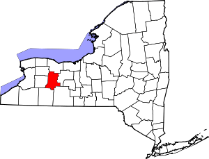 | |
| Villages | ||
| CDPs | ||
| Other hamlet | ||
This article is issued from
Wikipedia.
The text is licensed under Creative Commons - Attribution - Sharealike.
Additional terms may apply for the media files.