Lâm Đồng Province
| Lâm Đồng Province Tỉnh Lâm Đồng | |
|---|---|
| Province | |
 | |
 Location of Lâm Đồng within Vietnam | |
| Coordinates: 11°57′N 108°26′E / 11.950°N 108.433°ECoordinates: 11°57′N 108°26′E / 11.950°N 108.433°E | |
| Country |
|
| Region | Central Highlands |
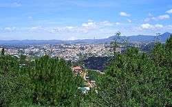
| Capital | Đà Lạt |
| Area | |
| • Total | 9,764.8 km2 (3,770.2 sq mi) |
| Population (2007) | |
| • Total | 1,198,800 |
| • Density | 120/km2 (320/sq mi) |
| Demographics | |
| • Ethnicities | Vietnamese, Cơ Ho, Mạ, Nùng |
| Time zone | UTC+7 (ICT) |
| Calling code | 63 |
| ISO 3166 code | VN-35 |
| Website |
www |
Lâm Đồng (Vietnamese: [ləm ɗôŋ] (![]()
Administrative divisions
Lâm Đồng is subdivided into 12 district-level sub-divisions:
| Second Tier subdivisions |
Area (km²) |
Third Tier subdivisions | ||
|---|---|---|---|---|
| Ward | Township | Commune | ||
| Bảo Lộc city | 232.20 | 6 | 5 | |
| Da Lat city | 394.64 | 12 | 4 | |
| Bảo Lâm District | 1465.00 | 1 | 13 | |
| Cát Tiên District | 427.20 | 2 | 9 | |
| Đạ Huoai District | 494.40 | 2 | 8 | |
| Đạ Tẻh District | 527.90 | 1 | 10 | |
| Đam Rông District | 892.20 | 2 | 8 | |
| Di Linh District | 1614.64 | 1 | 18 | |
| Đơn Dương District | 611.56 | 1 | 8 | |
| Đức Trọng District | 901.80 | 1 | 14 | |
| Lạc Dương District | 1312.33 | 1 | 5 | |
| Lâm Hà District | 979.52 | 2 | 14 | |
They are further subdivided into 12 commune-level towns (or townlets), 118 communes, and 18 wards.
Economy
The economy is based largely on agriculture, with tea, coffee and vegetables being the main agricultural products. Lâm Đồng Province is also famous for its main city - Đà Lạt. (Lâm Đồng attracted 3 million tourists in 2011)
The GDP of Lâm Đồng is nearly 1 billion US dollars in 2011.
In the Provincial Competitiveness Index 2011, Lâm Đồng is ranked 54 out of 63 provinces in Vietnam.
Attractions
- Cát Tiên National Park
- Bidoup Núi Bà National Park
- Lâm Đồng many beautiful waterfalls: Cam Ly, Prenn, Datanla, etc.
- Langbiang mountain
- Tuyen Lam lake
- Thung Lung Tinh Yêu (love valley)
- Pren
- Cát Tiên archaeological site
- Linh Phuoc Pagoda
External links
Places adjacent to Lâm Đồng Province | |
|---|---|