Lake Travis
| Lake Travis | |
|---|---|
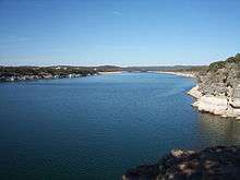
 View of Windy Point at Lake Travis with a full water level | |
| Location | Travis / Burnet counties, northwest of Austin, Texas |
| Coordinates | 30°23′31″N 97°54′24″W / 30.39194°N 97.90667°WCoordinates: 30°23′31″N 97°54′24″W / 30.39194°N 97.90667°W. |
| Lake type | Hydroelectric reservoir |
| Primary inflows | Colorado River |
| Primary outflows | Colorado River |
| Basin countries | United States |
| Surface area | 18,930 acres (7,660 ha) |
| Max. depth | 210 ft (64 m) |
| Water volume | 1,130,000 acre⋅ft (1.39 km3) |
| Shore length1 | 270 mi (434 km) |
| Surface elevation | 681 ft (208 m) |
| 1 Shore length is not a well-defined measure. | |

Lake Travis is a reservoir on the Colorado River in central Texas in the United States. The reservoir was formed in 1942 by the construction of Mansfield Dam on the western edge of Austin, Texas by the Lower Colorado River Authority (LCRA), and was built specifically to contain floodwaters in a flash-flood prone region. During its construction, after a severe flood in July 1938, the height of the dam was raised to add storage capacity for floodwaters.[1][2]
Lake Travis has the largest storage capacity of the seven reservoirs known as the Highland Lakes, and stretches 65 miles (105 km) upriver from western Travis County in a highly serpentine course into southern Burnet County to Max Starcke Dam, southwest of the town of Marble Falls. The Pedernales River, a major tributary of the Colorado River, flows into the lake from the southwest in western Travis County. The lake is used for flood control, water supply, electrical power generation, and recreation.
Recreational uses
Lake Travis is well-known for its outdoor recreation opportunities, including fishing, boating, swimming, scuba diving, picnicking, camping, and zip lining. Another recreational use, nude sunbathing and swimming, is permitted in Hippie Hollow Park. This picturesque park is located near the eastern end of Lake Travis and holds the distinction of being the only legal clothing optional park in Texas. Lake Travis is generally considered one of the clearest lakes in Texas. It is a vital water supply for the nearby city of Austin, Texas and the surrounding metropolitan area.
Fatality rankings
In ranking lakes in Texas for accidental fatalities, Lake Travis was in first-place in 2011 and tied for second-place for total deaths over the years 2000-2015.[3][4]
Flotation devices are recommended on Lake Travis.[5][6] According to the Travis County Sheriff's Office:
"Lake Travis is a dangerous body of water because it isn't actually a lake, it's a giant reservoir. It has a dynamic about it that’s unlike most other bodies of water. There are all kinds of things under the water that are obstacles. There’s low visibility. There are steep, steep drop-offs, and so, you can be standing in three feet of water, take a step, and you’re in 50 feet of water. We will have over 200,000 people visit Lake Travis every summer and there is a small percentage of people who die on our lake. But, any death is a significant death and we want to make sure that people are taking this lake seriously, and that means wearing a flotation device."[7]
Fish populations
Lake Travis has been stocked with several species of fish intended to improve the utility of the reservoir for recreational fishing. Fish present in Lake Travis include largemouth bass, guadalupe bass, white bass, striped bass, catfish and sunfish.
In spring 2008 there were several reports of leeches residing in Lake Travis. The leeches are generally harmless to humans but can be a nuisance.[8]
Lake levels
Lake Travis is considered "full" (at maximum desired capacity) when the lake's water level is at 681 feet (208 m) above mean sea level (msl). Above 681 feet (208 m), flood control gates at Mansfield Dam are opened under the direction of the U.S. Army Corps of Engineers.[9] The level of the lake can vary dramatically—with an over 96-foot range between its historical high and low—depending on the amount of rainfall in the Colorado River basin upstream.[10] The historic high level on the lake was 710.4 feet (216.5 m) above msl on December 25, 1991, a little less than four feet below the dam's top/spillway at 714 feet (218 m) above msl. The historic low was 614.2 feet (187.2 m) above msl on August 14, 1951.
Droughts
The extreme drought of 2008-2009 brought the lake to its fourth lowest level at 626.09 feet (190.83 m) above msl in November 2009. The second lowest level was 615.02 feet (187.46 m) above msl on November 8, 1963.[11] During the 2010–13 Southern United States drought, levels went as low as 618 feet, making it the third lowest level ever.[12] The LCRA, a public utility whose responsibilities include the management of Lake Travis, makes water level reports available on the internet.[13] In April 2016, the lake returned to its full capacity at 681 ft.
Floods
Lake Travis serves as the primary flood control reservoir of the Highland Lake chain. The LCRA, under advisement from the U.S. Army Corps of Engineers, is responsible for floodgate operations at Mansfield Dam. Ideally, this is done in a time-delayed fashion after a major rainfall so as to either mitigate or outright prevent downstream flooding which otherwise would have been both immediate and extreme without the dam's presence. As Lake Travis levels increase during major floods, floodgate operations are conducted to protect property around Lake Travis as well as the dam itself.
While the dam's physical design assists in its own protection during floods, extensive spillway operations, a worst-case scenario which has not happened in the lake's history, could undermine the dam's base and affect its overall integrity. Under such conditions, operations are primarily intended to protect the dam, and lake water may be released to the dam's full, 24-floodgate capacity—regardless of downstream effects—to prevent the catastrophic loss of the dam.[14] Including its hydroelectric generators but not the spillway, at 681 feet above msl the dam's total maximum discharge capacity is more than 130,000 cubic feet per second (cfs); a bit under one million gallons per second.[15] Rates of discharge increase as water levels/pressures increase.
See also
References
- ↑ "Mansfield Dam and Lake Travis". www.lcra.org.
- ↑
- ↑ "Sasser: Boating safety is made simpler if you take these five steps..." 18 May 2013.
- ↑ "Lake Conroe the Deadliest Lake in Texas - Baumgartner Law Firm". 1 March 2015.
- ↑ "Lake Travis death underscores importance of following boating safety measures". 24 May 2018.
- ↑ "Texas ranks number 2 in boating deaths, officials urge safety".
- ↑ Glas, Calily Bien, Brittany (21 August 2018). "Fourth death on Lake Travis this summer identified as Cedar Park man".
- ↑
- ↑ "LCRA dams form the Highland Lakes". www.lcra.org.
- ↑ Design, ATX Web. "Lake Travis Water Level". www.golaketravis.com.
- ↑ The lake rose to 642.39 feet above msl as of October 25, 2009 due to significant rains in September and October 2009. This places the level at 24 feet below normal level for October. "River Report" LCRA.
- ↑
- ↑
- ↑ "Key elevations for Lake Travis during floods". www.lcra.org.
- ↑ "LCRA dams form the Highland Lakes". www.lcra.org.
External links
| Wikimedia Commons has media related to Lake Travis. |
- Key Water Levels for Lake Travis During Floods
- "Lake Travis". Texas Parks and Wildlife. 2009-06-18. Retrieved 2009-09-03.
- "Mansfield Dam and Lake Travis". Lower Colorado River Authority. 2009-08-28. Retrieved 2009-09-03.
- Lake Travis from the Handbook of Texas Online
| Central city | | ||||
|---|---|---|---|---|---|
| Satellite cities | |||||
| Other communities | |||||
| Counties |
| ||||
| Parks and preserves |
| ||||
| Geography | |||||
| Bodies of water | |||||
| Transportation | |||||
Austin (capital) | ||
| Topics | ||
| Society | ||
| Regions |
| |
| Metropolitan areas |
| |
| Counties | ||
