Laghouat Province
| Laghouat Province ولاية الأغواط | |
|---|---|
| Province | |
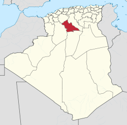 Map of Algeria highlighting Laghouat | |
| Coordinates: 33°48′N 2°53′E / 33.800°N 2.883°ECoordinates: 33°48′N 2°53′E / 33.800°N 2.883°E | |
| Country |
|
| Capital | Laghouat |
| Area | |
| • Total | 25,057 km2 (9,675 sq mi) |
| Population (2008)[1] | |
| • Total | 477,328 |
| • Density | 19/km2 (49/sq mi) |
| Time zone | UTC+01 (CET) |
| Area Code | +213 (0) 29 |
| ISO 3166 code | DZ-03 |
| Districts | 10 |
| Municipalities | 24 |
Laghouat (Arabic: ولاية الأغواط) is a province (wilaya) in central Algeria. The name means "the oases". The capital is Laghouat. Other localities include Aflu, Ḥasi Eṛṛmel, Ɛin Maḍi, Kurdan and Makhareg.
Geography
Location
Located at an altitude of 750 m, the Laghouat Province is part of the Saharian Atlas Mountains chain with some peaks above 2,000 m "Djebel Amour: 2,200 m"
Administrative division
The province is divided into 10 districts (daïras), which are further divided into 24 communes or municipalities.
Districts
Communes
Tourism

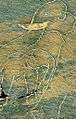

rock carvings El Ghicha
See also
References
- ↑ Office National des Statistiques, Recensement General de la Population et de l’Habitat 2008 Archived 2008-07-24 at the Wayback Machine. Preliminary results of the 2008 population census. Accessed on 2008-07-02.
| ||

This article is issued from
Wikipedia.
The text is licensed under Creative Commons - Attribution - Sharealike.
Additional terms may apply for the media files.