Algiers Province
| Algiers Province ولاية الجزائر | |
|---|---|
| Province | |
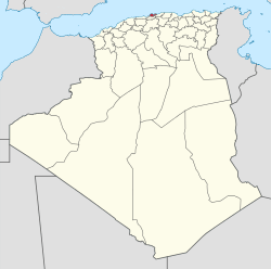 Map of Algeria highlighting Algiers | |
| Coordinates: 36°42′N 3°13′E / 36.700°N 3.217°ECoordinates: 36°42′N 3°13′E / 36.700°N 3.217°E | |
| Country |
|
| Capital | Algiers |
| Government | |
| • PPA president | Mohamed Zaïm (FLN) |
| • Wāli | Abdelkader Zoukh (since 2013) |
| Area | |
| • Total | 1,190 km2 (460 sq mi) |
| Population (2008)[1] | |
| • Total | 2,988,145 |
| • Density | 2,500/km2 (6,500/sq mi) |
| Time zone | UTC+01 (CET) |
| Area Code | +213 (0) 21 |
| ISO 3166 code | DZ-16 |
| Districts | 13 |
| Municipalities | 57 |
Algiers (Arabic: ولاية الجزائر Wilāyat al-Jazāʼir, French: Wilaya d'Alger) is a province (wilayah) in Algeria, named after its capital, Algiers, which is also the national capital. It is adopted from the old French département of Algiers and has a population of about 3 million. It is the smallest and most densely populated province of Algeria.
Administrative divisions
Algiers province is divided into 13 districts and 57 communes or municipalities.
Districts
The districts, listed according to official numbering (from west to east), are:
|
1. Zéralda |
8. Sidi M'Hamed |
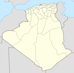
 The 13 districts of Algiers province |
Communes
The communes, listed alphabetically, are:
- Alger Centre
- Aïn Bénian
- Aïn Taya (Ain-Taya)
- Bab El Oued
- Bab Ezzouar
- Baba Hassen
- Bachdjerrah (Bach Djerrah)
- Baraki
- Ben Aknoun
- Bir Mourad Raïs
- Birkhadem (Bir Khadem)
- Birtouta
- Bologhine (Bouloghine)
- Bordj El Bahri
- Bordj El Kiffan (Bordj El Kifan)
- Bourouba
- Bouzaréah
- Béni Messous
- Casbah
- Chéraga
- Dar El Beïda
- Douéra
- Draria
- Dély Ibrahim (Dely Brahim)
- El Achour
- El Biar
- El Harrach
- El Madania
- El Magharia
- El Marsa
- El Mouradia
- Djasr Kasentina
- H'raoua
- Hammamet
- Hussein Dey
- Hydra
- Khraïcia
- Kouba
- Les Eucalyptus
- Mahelma
- Mohamed Belouizdad
- Mohammedia
- Oued Koriche
- Oued Smar
- Ouled Chebel
- Ouled Fayet
- Rahmania
- Raïs Hamidou
- Reghaïa
- Rouïba
- Saoula
- Sidi M'Hamed (Sidi Mhamed)
- Sidi Moussa
- Souidania
- Staouéli
- Tessala El Merdja
- Zéralda
People
- Lyès Deriche, 20th-century leader of the Algerian national political movement against the French.
References
External links
- (in French) "Alger, Capitale previligiée pour l'investissement" (Archive) - National Agency of Investment Development (Agence Nationale de Développement de l'Investissement or ANDI, الوكالة الوطنية لتطوير الاستثمار)
| ||
This article is issued from
Wikipedia.
The text is licensed under Creative Commons - Attribution - Sharealike.
Additional terms may apply for the media files.