Constantine Province
| Constantine Province ولاية قسنطينة | |
|---|---|
| Province | |
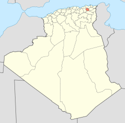 Map of Algeria highlighting Constantine | |
 Map of the 6 districts of Constantine | |
| Coordinates: 36°21′N 6°36′E / 36.350°N 6.600°ECoordinates: 36°21′N 6°36′E / 36.350°N 6.600°E | |
| Country |
|
| Capital | Constantine |
| Area | |
| • Total | 2,187 km2 (844 sq mi) |
| Population (2008)[1] | |
| • Total | 943,112 |
| • Density | 430/km2 (1,100/sq mi) |
| Time zone | UTC+01 (CET) |
| Area Code | +213 (0) 31 |
| ISO 3166 code | DZ-25 |
| Districts | 6 |
| Municipalities | 12 |
Constantine (Arabic: ولاية قسنطينة) is one of the 48 provinces (wilayas) of Algeria, whose capital is the city of the same name.
Administrative divisions
The province is divided into 6 districts or daïra, which are subdivided into 12 communes or municipalities.[2]
List of districts
| District | Number of municipalities |
Municipalities | Area (km²) |
Population (hab.) |
|---|---|---|---|---|
| Constantine | 1 | Constantine | 231.63 | 448,374 |
| El Khroub | 3 | El Khroub • Aïn Smara • Ouled Rahmoune | 610.70 | 242,163 |
| Aïn Abid | 2 | Aïn Abid • Ibn Badis | 634.22 | 50,478 |
| Zighoud Youcef | 2 | Zighoud Youcef • Beni Hamiden | 367.97 | 44,645 |
| Hamma Bouziane | 2 | Hamma Bouziane • Didouche Mourad | 186.88 | 124,903 |
| Ibn Ziad | 2 | Ibn Ziad • Messaoud Boudjeriou | 257.37 | 27,911 |
References
- ↑ Office National des Statistiques, Recensement General de la Population et de l’Habitat 2008 Archived July 24, 2008, at the Wayback Machine. Preliminary results of the 2008 population census. Accessed on 2008-07-02.
- ↑ "The official journal of People's Democratic Republic of Algeria" (PDF). SGG Algeria. Retrieved 2007-11-06.
| Constantine District | | |
|---|---|---|
| Aïn Abid District | ||
| El Khroub District | ||
| Hamma Bouziane District | ||
| Ibn Ziad District | ||
| Zighoud Youcef District | ||
| ||
Planning
An Willaya Was Almost 1,103,102 Population In 2030 A New City Of El- Menia A New Exhibition Centre A New Cultural District (Including Zoos)
This article is issued from
Wikipedia.
The text is licensed under Creative Commons - Attribution - Sharealike.
Additional terms may apply for the media files.