Jijel Province
| Jijel Province ولاية جيجل ⵉⵖⵉⵍ ⴳⵉⵍⵉ Wilaya de Jijel | |
|---|---|
| Province | |
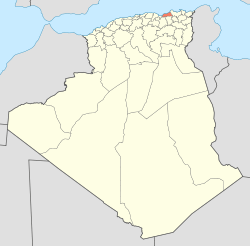
 Map of Algeria highlighting Jijel | |
| Coordinates: 36°48′N 5°46′E / 36.800°N 5.767°ECoordinates: 36°48′N 5°46′E / 36.800°N 5.767°E | |
| Country |
|
| Capital | Jijel, Algeria |
| Area | |
| • Total | 2,577 km2 (995 sq mi) |
| Population (2008)[1] | |
| • Total | 634,412 |
| • Density | 250/km2 (640/sq mi) |
| Time zone | UTC+01 (CET) |
| Area Code | +213 (0) 34 |
| ISO 3166 code | DZ-18 |
| Districts | 11 |
| Municipalities | 28 |
Jijel (Arabic: ولاية جيجل, Berber languages: ⵉⵖⵉⵍ ⴳⵉⵍⵉ, French: Wilaya de Jijel) is a province (wilaya) in Algeria , part of the Kabylie region, on the eastern Mediterranean coast. The capital is Jijel (Berber name : Igilgili). Taza National Park is located in this province.
Administrative divisions
The province is divided into 11 districts, which are further divided into 28 communes or municipalities.
Districts
Communes
- Bordj T'har
- Boucif Ouled Askeur
- Boudriaa Ben Yadjis
- Bouraoui Belhadef
- Chahna
- Chekfa
- Djemaa Beni Habibi
- Djimla
- El Ancer
- El Aouana
- El Kennar Nouchfi
- El Milia
- Emir Abdelkader
- Eraguene
- Ghebala
- Jijel
- Kaous
- Kheïri Oued Adjoul
- Ouadjana
- Ouled Rabah
- Ouled Yahia Khedrouche
- Selma Benziada
- Settara
- Sidi Abdelaziz
- Sidi Maarouf
- Taher
- Texenna
- Ziama Mansouriah
References
- ↑ Office National des Statistiques, Recensement General de la Population et de l’Habitat 2008 Archived 2008-07-24 at the Wayback Machine. Preliminary results of the 2008 population census. Accessed on 2008-07-02.
External links
- (in French) Official website of the Province
- (in French) Jijel local on-line news
- (in French) Jijel news
- (in French) Jijel on-line
- (in French) Djidjelli.com
| ||
This article is issued from
Wikipedia.
The text is licensed under Creative Commons - Attribution - Sharealike.
Additional terms may apply for the media files.