Kulp, Turkey
| Kulp | |
|---|---|
| City | |
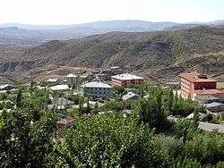 The city of Kulp | |
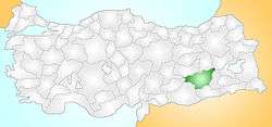 Location of the district of Diyarbakır within Turkey. | |
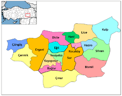
 Kulp Location of Kulp | |
| Coordinates: 38°31′N 41°01′E / 38.517°N 41.017°E | |
| Country |
|
| Region | Southeastern Anatolia Region |
| Government | |
| • Mayor | Metin Dinar (BDP) |
| Area[1] | |
| • District | 1,609.68 km2 (621.50 sq mi) |
| Population (2012)[2] | |
| • Urban | 11,205 |
| • District | 37,191 |
| • District density | 23/km2 (60/sq mi) |
| Time zone | UTC+2 (EET) |
| • Summer (DST) | UTC+3 (EEST) |
| Postal code | 21900 |
| Area code(s) | 412 |
| Licence plate | 21 |
Kulp (Ottoman Turkish: قولب Qulb, central district: Ottoman Turkish: پاصور Pasur,[3] Kurdish: Pasûr, Zazaki: Pasor) is a district of Diyarbakır Province in Turkey. The population was 10,119 in 2010.
History
The Kulp region gained importance as a center for the Kurdish chiefdoms in Kulp itself & nearby Zeyrek (to the west)
Sources
- ↑ "Area of regions (including lakes), km²". Regional Statistics Database. Turkish Statistical Institute. 2002. Retrieved 2013-03-05.
- ↑ "Population of province/district centers and towns/villages by districts - 2012". Address Based Population Registration System (ABPRS) Database. Turkish Statistical Institute. Retrieved 2013-02-27.
- ↑ Tahir Sezen, Osmanlı Yer Adları (Alfabetik Sırayla), T.C. Başbakanlık Devlet Arşivleri Genel Müdürlüğü, Yayın Nu 21, Ankara, p. 328.
Coordinates: 38°30′06″N 41°00′42″E / 38.5016666667°N 41.0116666667°E
This article is issued from
Wikipedia.
The text is licensed under Creative Commons - Attribution - Sharealike.
Additional terms may apply for the media files.