Krasnodon
Coordinates: 48°18′N 39°44′E / 48.300°N 39.733°E
| Krasnodon Краснодон | |||
|---|---|---|---|
| City of regional significance | |||
| Krasnodon / Sorokyne | |||
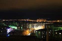 Krasnodon skyline | |||
| |||
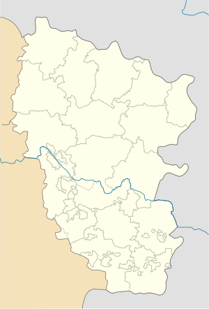 Krasnodon Location of Krasnodon/Sorokyne  Krasnodon Krasnodon (Ukraine) | |||
| Coordinates: 48°18′0″N 39°44′0″E / 48.30000°N 39.73333°E | |||
| Country Oblast |
Luhansk Oblast | ||
| Founded | 1914 as Sorokino | ||
| Renamed | 1938 | ||
| Government | |||
| • Mayor | Yuri Borisovich Baklagov [1] | ||
| Area | |||
| • Total | 77.33 km2 (29.86 sq mi) | ||
| Population (2013) | |||
| • Total | 44,283 | ||
| Postal code | 94400 | ||
| Area code(s) | +380 6435 | ||
| Climate | Dfa | ||
| Website |
krasnodon | ||

Krasnodon (Ukrainian, Russian: Краснодон) is a city in Luhansk Oblast (region) of eastern Ukraine. It is incorporated as a city of oblast significance and serves as the administrative center of Krasnodon Raion (district), though it does not belong to the raion. Its population is approximately 43,683 (2017 est.)[2].
Population of Krasnodon in 1972 was 70,400, in 1989 it was around 53,000, in 2001 it was 49,921.[3]
In 2016 the city was renamed into Sorokyne (Ukrainian: Сорокине; Russian: Сорокино) as part of decommunization in Ukraine. The city's name change process is temporarily suspended as it is not controlled by the government of Ukraine.
History
Krasnodon was established in 1914 along the banks of the Velyka Kamyanka, a tributary of the Seversky Donets River, as the settlement of Sorokino. It soon became one of the centers of the coal mining industry of the Donbass region. By the Decision of the Presidium of the Supreme Soviet of the USSR, on 28 October 1938 it was renamed to Krasnodon.
During the German-Soviet War, Krasnodon was occupied by Nazi Germany from July 20, 1942 to February 14, 1943. The Soviet Komsomol organization resistance Young Guard operated in the city from October 1942 to January 1943, when most of its members were arrested and executed. The Young Guard are commemorated with monuments and a memorial complex in Krasnodon.
Since 2014, Krasnodon has been controlled by the Luhansk People's Republic and not by Ukrainian authorities.[4] NATO released satellite data from 21 August 2014 and confirmed it showed a large column of armoured vehicles crossing into Ukraine from Russia through Krasnodon.[5]
Demographics
As of the Ukrainian Census of 2001:[6]
- Ethnicity
- Russians: 63.3%
- Ukrainians: 33.2%
- Belarusians: 1.3%
- Other: 2.2%
- Language
- Russian: 90.75%
- Ukrainian: 8.46%
- Romani: 0.17%
- Armenian: 0.15%
- Belarusian: 0.12%
Gallery
 Bolshaya Kamenka River in Krasnodon
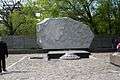 Grieving mother monument
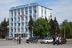 Krasnodon Coal Company
 A trolleybus in Krasnodon
See also
External links
- (in Russian) Official city page
References
- ↑ Городской голова (in Russian). Krasnodon Official City Page. Retrieved March 19, 2009.
- ↑ "Чисельність наявного населення України (Actual population of Ukraine)" (in Ukrainian). State Statistics Service of Ukraine. Retrieved 26 August 2017.
- ↑ Численность и состав населения Украины (in Russian). ukrcensus.gov.ua. Archived from the original on March 29, 2009. Retrieved March 19, 2009.
- ↑ "Численность населения по состоянию на 1 октября 2015 года по Луганской Народной Республ ике" (PDF) (in Russian). Luhansk People's Republic. Archived from the original (PDF) on 4 February 2016. Retrieved 21 December 2015.
- ↑ "New Satellite Imagery Exposes Russian Combat Troops Inside Ukraine". 28 August 2014. Retrieved 31 August 2014.
- ↑
| Raions | |||||
|---|---|---|---|---|---|
| Cities |
| ||||
| |||||